13. Testing QGIS Python API and Atlas plugin for QGIS

Mentors: Jiri Kvapil, Jan Vrobel

QGIS is important application in Free and Open Source Software domain for GIS and spatial data processing. It is a professional GIS application with powerful tools and components. Support for Python scripting is one of these powerful components.
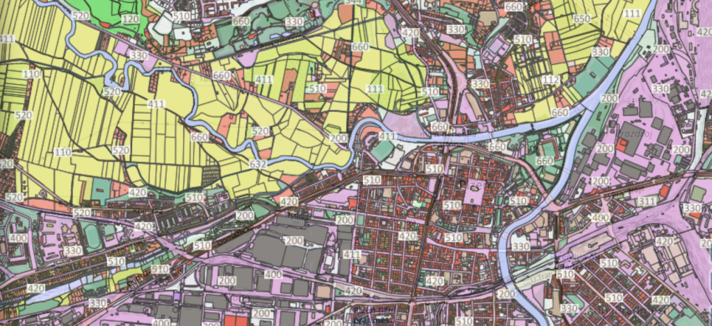
Atlas plugin for QGIS is a new tool for GIS users familiar with desktop GIS to prepare map composition for Web map applications. GIS user can prepare composition from local layers on desktop and publish this composition with all layers to the Web with Layman application.

Challenge description: The goal of this challenge is to test QGIS Python API on PoliRural DIH or WRLS AgriHub that are being developed and will be presented during the Hackathon. Testing of the Atlas plugin can be done simultaneously while preparing data layers with the Python API.

12. Testing new data model for Open Land Use

Mentor: Michal Kepka, Dmitrii Kozhukh

Open Land Use is a pan-European open dataset integrating various regional and local spatial datasets about land cover and land use. More information about the dataset can be found at: https://sdi4apps.eu/open_land_use/
Several H2020 projects brought new requirements and challenges for OLU data set in last months. For example, there are requirements to integrate data about geomorphology, climate, soils etc. into the dataset.
Due to this fact, new data model of OLU, that is easily extendible to new attributes, was designed during last weeks and it is being developed at this moment.

Challenge description: The goal of this challenge is to test new data model to input datasets and to test publication of data as WMS over publication server and as file export.

11. Noise modelling with TraMod data

Mentor: Tomas Nekut

Traffic Modeller (TraMod) is a tool for transport modeling developed in collaboration between traffic engineers, IT and GIS specialist. It can be fully implemented in server environment with an application programming interface for mobile and web applications. This creates an opportunity for a city or a region government representatives to test various traffic scenarios within seconds without a need to install and learn how to use desktop traffic modelling software or contacting traffic engineers every time a new roadwork appears in the region.

Challenge description: The goal of this challenge is to find a way to use TraMod output data as an input for an open source noise modelling SW.

10. OSM data for TraMod

Mentor: Pavel Blahnik

Traffic Modeller (TraMod) is a tool for transport modeling developed in collaboration between traffic engineers, IT and GIS specialist. It can be fully implemented in server environment with an application programming interface for mobile and web applications. This creates an opportunity for a city or a region government representatives to test various traffic scenarios within seconds without a need to install and learn how to use desktop traffic modelling software or contacting traffic engineers every time a new roadwork appears in the region.

Challenge description: The goal of this challenge is to prepare OSM data in such a way that the data is usable for traffic modelling using TraMod.

9. Building SIEUSOIL Metadata profile for Soil Data

Mentors: Tomas Pavelka, Tomas Reznik, Lukas Herman, Karel Charvat

The SIEUSOIL Hub is designed and implemented as an open source webGIS system and is called the SIEUSOIL Eurasian Soil Platform or SIEUSOIL Platform. This soil platform is composed from next Open Source components:

  • OpenMicka
  • Geoserver
  • Mapserver
  • Layman
  • Postgis
  • Postgress
  • Virtuoso

Challenge Description: To design SIEUSoil Metadata profile and implement this metadata profile in OpenMicka Platform as a proof-of-concept for linking geospatial data and services on the level of their metadata descriptions. The secondary goal is to collect/adopt/transform metadata from existing metadata sources related to soil platform and publish this metadata in SIEUSoil metadata catalogue.

8. Analysis of climatic trends in selected regions

Mentor: Jaroslav Šmejkal

The main components of EUXDAT & Stargate Climatic data processing HUB are the following:

  • EUXDAT Portal: It is the entrance point to EUXDAT functionalities. It provides a web GUI which gives access to the workflow execution tool, monitoring of data analytics execution, the catalogue and other useful tools;
  • Identity and Authorization Manager: This component is responsible of managing user accounts and managing access to the functionalities and data in EUXDAT, according to security policies and to the rights granted to each user;
  • Data & Algorithms Catalogue: It keeps a record of all the algorithms, applications and datasets which are available in EUXDAT;
  • Data & Algorithms Repository: This component deals with the storage of datasets, algorithms and images, in general, that will be used for running data analyses;
  • Data Manager: It is the component in charge of moving data to the proper location. It will configure and operate extraction APIs for accessing several data sources. For doing so, it also has all the data connectors that are necessary;
  • SLA Manager: It agrees on quality attributes to fulfil and the values to be met for each attribute. It also retrieves information about the monitoring of such attributes in order to detect SLA breaches;
  • Orchestrator: It deals with the management of resources, mainly from the functional perspective, deploying the algorithms and the corresponding data in the optimal location. It also deals with the application profiles generation and management;
  • Monitoring: It retrieves information about the resources execution and status, as well as about the algorithms execution and datasets status.

Challenge Description: Analysis of climatic trends in selected regions

Analysis of situation and climatic trends in regions for following variabled: precipitation, evaporation, sunny days and temperature.

7. Testing possibilities of Sentinel 1 data for yield forecast

Mentors: Karel Charvat, Jiri Kvapil

WirelessInfo is part of the SmartAgirHub project. Currently we are also closely cooperating with the PoliRural project in this direction. We see three roles of Digital Innovation Hubs in the future:

  • Social space and educational materials, where different groups of users can share their experiences and where users could be trained
  • Place where different types of users can test new applications
  • Place for developers, where advanced infrastructure will be available for practical testing

Our work during the hackathon will be focused on the last topic. We are now publishing on our cloud set of tools for EO, IoT, Big Data Management, AI, etc. We are also implementing tools like Jupyter Notebook.  Set of tools like SensLog, Orfeo Geotool, R, Grass, Micka, HSLayers NG and others are available. The hub also offer graphical card and framework for Artificial intelligence

The part of Hub are also Sentinel 1 and 2 images from Moravia and farm data from Rostenice

Challenge Description Testing possibilities of Sentinel 1 data for yield forecast: 

Tested possibilities of uf utilisation of Sentinel 1 data for yield monitoring and forecast on Rostenice farm and comparison with utilisation of Sentinel 2 and Landsat dataSpecial prize: One year of free access to the SmartAgriHub innovation hub.

6. Using AI algorithms for defining boundaries of agriculture fields on the base of Sentinel 2 Images.

Mentors: Hana Kubickova, Jan Horak, Ondrej Kaas, Jiri Kvapil

WirelessInfo is part of the SmartAgirHub project. Currently we are also closely cooperating with the PoliRural project in this direction. We see three roles of Digital Innovation Hubs in the future:

  • Social space and educational materials, where different groups of users can share their experiences and where users could be trained
  • Place where different types of users can test new applications
  • Place for developers, where advanced infrastructure will be available for practical testing

Our work during the hackathon will be focused on the last topic. We are now publishing on our cloud set of tools for EO, IoT, Big Data Management, AI, etc. We are also implementing tools like Jupyter Notebook.  Set of tools like SensLog, Orfeo Geotool, R, Grass, Micka, HSLayers NG and others are available. The hub also offer graphical card and framework for Artificial intelligence

The part of Hub are also Sentinel 1 and 2 images from Moravia and farm data from Rostenice

Challenge Description Using AI algorithms for defining boundaries of agriculture fields on the base of Sentinel 2 Images: 

To test different deep learning methods for analysis of multitemporal Sentinel 2 data to detect boundaries of fields

Special prize for best student or freelance  in EU: coverage of cost related with participation on in situ part of Prague Hackathon including tickets and hotel

5. Clustering of European NUTS 3 regions based on different parameters

Mentor: Karel Charvat

The Polirural innovation Hub will be central real and virtual space, where all stakeholder (policymakers, public servant, regional development agencies, NGO, citizens, scientist, developers, data experts, planners) will meet and share their needs and achievements to improve policy and decision making on local, regional and eventually national level. The core  of Innovation Hub will be platform Digital Innovation Hub (DiH). This DiH will also support sharing of information with other projects and initiatives. Innovation Hub objectives:

  • offer access to data cross European NUTS3 regions
  • Offering other pan european Data sets like Open Land Use, Smart Point of Interest
  • offer development environment based on Jupyter notebook and list of other tools supporting development of new application
  • HSlayers NG

Challenge Description Clustering of European NUTS 3 regions based on different parameters: The goal is to develop applications, which will support clustering of European NUTS 3 . The Apps will allow to select different parameters from existing database, provide clustering on base of this parameters and visualise results

4. Web solution for attractiveness of regions

Mentor: Otakar Cerba

The PoliRural innovation hub will be a central real and virtual space, where all stakeholders (policymakers, public servant, regional development agencies, NGO, citizens, scientist, developers, data experts, planners) will meet and share their needs and achievements to improve policy and decision making on local, regional and eventually national level. The PoliRural Digital Innovation Hub will support sharing of information with other projects and initiatives. The Innovation Hub objectives are:

  • offer access to data cross European NUT3 regions
  • Offering other pna European Data sets like Open Land Use, Smart Point of Interest
  • offer development environment based on Jupyter notebook and list of other tools supporting development of new applications
  • HSlayers NG

Challenge Description: Web solution for attractiveness of regions

1. Development of web tool dealing with rural attractiveness data. The tool will use pre-prepared data. It will enable to filter data (select concrete data sets or group of data sets corresponding with an attribute of rural attractiveness) and to weight data (assign weight/importance to concrete data or groups of data sets).

2. Development of a live database following selected resources. The database will provide data for calculation of rural attractiveness, including providing information about the quality and reliability of data in particular NUTS3 regions
Special prize for best student in EU: coverage of cost related with participation on in situ part of Prague Hackathon including tickets and hotel