Webinar Recording: Mobilizing Capacity Development in Agriculture for Smallholder Farmers

In case you missed webinar dedicated to Mobilizing Capacity Development in Agriculture for Smallholder Farmers: How to bridge the digital divide by Foteini Zampati (GODAN), Suchith Anand (GODAN), Kiringai Kamau (GODAN) and Valeria Pesce (FAO), do not panic – you have an excellent opportunity to replay this webiar!

All presenstations available here:

Ethical and legal questions about smart farming. How do farmers feel about their data? – Foteini Zampati (GODAN)

Mobilizing Capacity Development in Agriculture for Smallholder Farmers – How to bridge the digital divide? – Suchith Anand (GODAN)

Codes of conduct for farm data sharing: Rationale, review, recommendations – Valeria Pesce (FAO)

Bridging the Digital Divide Through Consumer Driven Agricultural FarmHub Data Sourcing – Kiringai Kamau (GODAN)

Webinar Recording: Machine Learning and DataCubes


Did you miss livestream of yesterday’s webinar on Machine Learning algorithms and their use for objects in satellite images? We have a recording for you :)

Deep Learning techniques for boundaries detection (Hana Kubíčková, Plan4all)

Supporting food security with satellite image classification (Jan Chytrý, Masaryk University)

DATACUBES: Conquering Space & Time (Peter Baumann, Jacobs University/rasdaman GmbH)

FREE Webinar on Friday 3rd April

Webinar dedicated to Risk mapping and impact analysis of the desert locust invasion in East Africa is coming soon! The webinar is scheduled for Friday 3rd April 2020 and below you can find the overview and more details.

DURING THIS FREE WEBINAR YOU WILL LEARN:

  • Operational challenges in curbing the Locusts
  • Availability of data and technology to perform risk mapping and monitoring
  • Identifying potential areas for innovation
  • Impact assessment
  • Q&A related to the Kampala INSPIRE hackathon Challenge Desert Locust


What: This webinar is part of the series of webinars that will be conducted for the desert locust challenge. During this webinar, we will introduce the challenge, mentors and participants as well as introduce our approach for this challenge. The webinar brings together diverse groups of people including representatives from FAO who are at the heart of updating the world as well as funding different organisations in the struggle through FAO Emergencies, representatives from the Ministry of Agriculture Uganda who are at the centre of the fight locally, representatives from the Desert Locust Control Organisation for Eastern Africa (DLCO-EA) and the Regional Centre For Mapping Resource For Development (RCMRD) as well as innovators who will design appropriate solutions for this challenge through the hackathon. We shall explore the various technologies and operation tactics used by different bodies to combat the spread and breeding of locusts as well as enable our innovators to identify different areas of innovation from the lessons shared by speakers. As many countries across East Africa are battling with the challenge of desert locusts at the moment, it is important to support local initiatives through feasible innovations. Therefore, the webinar will be a stepping stone and pointer for how the Desert Locust Challenge Hackathon shall be carried out

Why: Many countries across East Africa are battling the challenge of desert locusts at the moment as they move across the region. It is therefore important to support local initiatives to monitor and control the locusts, with relevant geospatial risk maps of outbreak for the timely location of desert locust development and gregarization risk zones. It is important to come up with innovative ways for early detection of the locusts to avoid greater loss and enable quicker intervention.

Who (is the webinar for): Farmers and farmers’ associations, academia and researchers, and NGO’s, policy makers, governments

If you are interested in this topic, do not hesitate to register HERE!

All-Virtual Kampala INSPIRE Hackathon 2020 – ethics and legal aspects of open data

The Kampala INSPIRE Hackathon has gone virtual and our partners GODAN and UN FAO are, together with all the other 16 partners making it happen! Originally planned as an event to run remotely, culminating in an onsite event at the University of Makerere early May, the hackathon will – as before – consist of a series of educational webinars, online meetings, chat streams, and co-authored online documents, ending with a virtual workshop on May 6th 2020. The final workshop will contain a series of presentations outlining the results of the projects, followed by the evaluation and decision of the judging panel.

Each team, as part of their individual projects, will produce webinars for capacity building.

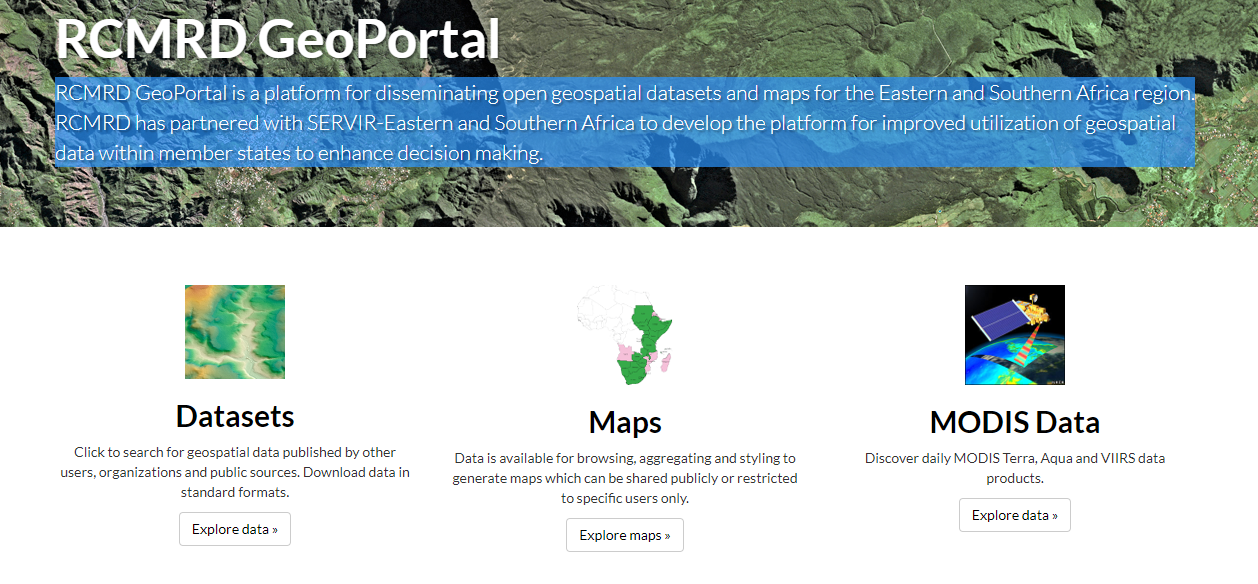
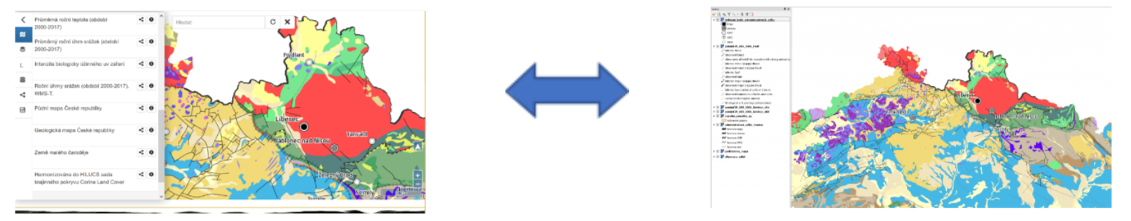
In order to make open data interoperable non-technical as well as technical challenges have to be addressed.

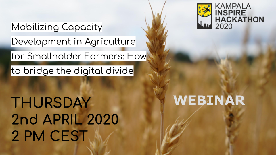
On the 2nd of April at 14.00 CEST a Webinar on the subject of Mobilizing Capacity Development in Agriculture for Smallholder Farmers: How to bridge the digital divide will take place.

The Webinar, covering the ethical, legal and policy issues around open data in digital agriculture is part of the submissions for Challenge 9 Ethical and legal aspects of open data affecting farmers on the ethical and legal aspects of open data affecting farmers, in which GODAN will be participating alongside helping organise the hackathon.

During this webinar the participants will be able to learn about:

  •       The risks and benefits of open data sharing in agriculture,
  •       Ethical approaches to opening data to benefit smallholder farmers,
  •       The impacts of digital technologies on different segments of agri-food value chains,
  •       The digital divide; and,
  •       Open data capacity building.

GODAN provided a further in-depth analysis on data governance, good practice on data flows and efforts to build capacity development, through a CTA/GODAN Data Rights and Responsible Data Working Group Webinar on the 31st of March at 14h00 CEST. The Webinar entitled Role of Codes of Conduct in Smart Farming and FAIR Data Sharing. If you missed the enrolment to take part, it will shortly be available to view on the GODAN Web site.

To enable all stakeholders in agri-food systems, especially farmers, to benefit from the agricultural digital revolution, sustainable solutions to support and encourage data sharing need to be found. Codes of conduct, voluntary guidelines, and principles on transparent governance of farm data constitute an important first step, putting basic issues such as data ownership, data rights, data privacy and data security into an ethical framework in which all stakeholders, especially farmers, can and should be involved.

In this webinar, conducted in the form of a virtual panel session, an “ideal” code of conduct will be discussed. The presenters will explore what such a code of conduct should look like from a general perspective, attempting to balance the interests of all actors involved, though focusing more specifically on the perspective and needs of the farmers.

Foteini Zampati, GODAN’s  Data Rights Research Specialist, will moderate the panel session, joined by four panellists who are experts in the fields of data rights and agricultural technology: Alice Namuli Blazevica, a tech lawyer and  partner in Tech & Innovation at Katende, Ssempebwa & Co Advocates; Stephen Kalyesubula, a certified computer engineer and  currently a project manager at Youths in Technology and Development Uganda  (YITEDEV-Uganda), Dr R. Andres Ferreyra, Data Asset Manager for Syngenta’s Global Digital Agriculture team; and, Hamulus Owoyesiga, a farmer, Youth ICT Head and Drone Operator at IGTF-Uganda. The panelists will have the opportunity to  share their experience and different perspectives on agricultural codes of conduct.

This Webinar was recorded and will be made available to all the participants of Challenge 9 Ethical and legal aspects of open data affecting farmers of the Kampala INSPIRE Hackathon.

Stay tuned for more information.

Upcoming Webinar on Wednesday 1st April

There is an upcoming webinar dedicated to Machine learning algorithms and their use for detection of objects in satellite images. The webinar is scheduled for Wednesday 1st April 2020 and below you can find the overview and more details.

DURING THIS FREE WEBINAR YOU WILL LEARN:

  • Why is field boundaries detection important for agriculture?
  • What are current emphasis on AI in relation to satellite data?
  • What  ML algorithms can be used for land cover classification?
  • Learn more about Using ML for detection of Land Use Objects
  • Introduction to datacubes, OGC coverages, coverage services, rasdaman, python API,
  • Services available for both Dubrovnik INSPIRE hackathon and Kampala INSPIRE hackathon challenges.

What: In this webinar we will explore possible machine learning algorithms and artificial neural networks that can be used for field boundaries detection from Sentinel 2 or Landsat images. Relevance to several of the Dubrovnik INSPIRE hackathon challenges as well as challenges of the Kampala INSPIRE hackathon will be highlighted.

Why: Accurate information on field boundaries is very important input for many reasons: eg. having accurate information on crop types and boundary defining a given soil block, we can for example determine the yield potential or the amount of fertilizer needed for given type of crop very precisely.

One of the possible ways is to exploit the potential of satellite imagery (Sentinel 2 or Landsat images), which provide a wealth of information about Earth’s surface and are available as open data. In conjunction with machine learning algorithms, we can get very interesting inputs for precision agriculture.

Who (is the webinar for): Academia & Research Researchers and Innovators who are engaged with solution of challenges related to AI and satellite images. Farmers’ associations and agricultural companies. Any possible participant of the Kampala Hackathon, who is considering his/her participation in this challenge.

If you are interested in this topic, do not hesitate to register HERE!

RCMRD as a co-organizer of Kampala INSPIRE Hackathon

The Regional Centre for Mapping of Resources for Development (RCMRD) is an intergovernmental organization that seeks to promote sustainable development through generation, application and dissemination of Geo-Information and allied Information to its 20 member states and stakeholders.
RCMRD works with its partners to promote the co-development, application and uptake of satellite derived products. This is achieved by making tools, applications and data and information more readily available through different initiatives. Some of the freely available tools are listed below.

RCMRD GeoportalOpen Data Portal

The geoportal and open data portal are repositories for datasets, maps and freely available satellite imagery. The open data portal also provides links to RCMRD application portals by thematic area, hazard maps and atlases and additional functionality to interact with a diverse set of datasets.

Link: http://geoportal.rcmrd.org/


Link: http://opendata.rcmrd.org/

The RCMRD Early Warning Explorer

The RCMRD Early Warning eXplorer (EWX) is a web-based application for exploration of geospatial data related to drought monitoring and famine early warning, customized for application in the African countries. It includes datasets such as rainfall at 5km, maximum temperature, rainfall forecasts and NDVI. The EWX enables scientists, analysts, and policymakers to view diverse data sets side-by-side in the same spatial bounding box, while also stepping through sequences of multiple time-series data sets. The EWX also allows users to view different statistics for user-selected regions by administrative zone, crop zone, hydrologic zones, grazing areas, or country.

Link: http://data.rcmrd.org/ewx-viewer/

The Global Agricultural Monitoring System

Coverage: Global with regional customizations

RCMRD through SERVIR Eastern and Southern Africa Project has been partnering with the University of Maryland have been building capacity in agricultural monitoring using tools such as the GLAM. The GLAM system is a customized web-based information-analysis and data-delivery system that allows users to monitor crop conditions and to locate and track the factors impairing agricultural productivity. This system provides crop analysts with a suite of MODIS temporal composites of vegetation index data, false color imagery, and a dynamic crop mask. Complementing these data products is a range of web-based analysis tools that allow analysts to interrogate these data and to drill down to the pixel level of detail. Using these data and tools analysts track the evolution of the growing season, make inter-annual comparisons of season dynamics and inform decision makers of agricultural conditions and impediments to worldwide food-security.

Link: http://pekko.geog.umd.edu/glam/east-africa/index.php

Challenge #3: Deep learning for weather forecast

Mentors: Ondrej Kaas, Jan Horak, Michal Kepka

The goal of the challenge is the adaptation of machine learning for the weather forecast in the local environment. The global historical data about climate conditions over a specific area (i.e. temperature, humidity, etc.) and also with greater dense time-series from sensors covering the same area will be used. The precise combination of these data with a compound of algorithms of deep learning can lead to weather forecast enhancement. The entire problem can be seen as a prediction of multivariate spatial data with different accuracy and importance.

In the machine learning domain, several approaches are used to extract multivariate sequence dependence.

In the field of neural networks, there are exists a kind called recurrent neural network (RNN) into which belongs architecture Long Short Term Memory (LSTM). LSTMs are explicitly designed to avoid the vanishing gradient problem. Hence there broadly used for time-series prediction.

Further, a radial basis function (RBF) networks are commonly used for function approximation problems. An RBF network is a type of feedforward neural network composed of three layers that use radial basis functions as activation functions. These networks are distinguished from other neural networks due to their universal approximation and faster learning speed.

And last, not least Bayesian Neural Network (BNN). Bayesian Neural Networks (BNN) is NN whose weights or parameters are expressed as a distribution rather than a deterministic value and learned using Bayesian inference. Their innate potential to simultaneously learn complex non-linear functions from data and express uncertainties.

Available tools:

  • Web-based JupyterHub exposing Anaconda environment.

Tasks for this challenge can be wrapped-up as follows:

  • Preparation of training data that precisely combinate the global and local phenomenons
  • Adaptation of several machine learning approaches and compare the prediction among them.

Yes, I want to register for Challenge #3!

CODE-DE Datacube service supports Dubrovnik and Kampala INSPIRE hackathons

Datacubes form an enabling paradigm for serving massive spatio-temporal Earth data in an analysis-ready way by combining individual files into single, homogenized objects for easy access, extraction, analysis, and fusion – “one cube says more than a million images”. Goal is to allow users to “ask any question, any time, on any size” thereby enabling them to “build their own product on the go”, to cite some common terms.

With the OGC Web Coverage Service (WCS) suite a set of easy-to-handle, flexible, powerful service APIs is in common use today. In the hackathon you have the opportunity to access spatio-temporal datacubes for extraction, visualization, analytics, and fusion of data.
Just find your Jupyter datacube notebook on the CODE-DE Sentinel hub https://processing.code-de.org/rasdaman/index.html?page=demonstrations, it offers a convenient quick step-by-step introduction.

CODE-DE, the German Sentinel Hub, can offer following data coverage:


Challenge 12: Interchangeable map compositions in support of collaborative spatial intelligence

Mentors: Raitis Berzins, Runar Bergheim, Karel Charvat, Dmitrij Kozuch, Jan Vrobel and Irena Koskova

Significant progress has been made in standardization of data access protocols and implementation of servers and clients capable of combining and visualizing remote datasets through mainstream OGC standards like WMS and WFS. This allows information to be flexibly re-used across organizational and thematic boundaries.

This allows people to build spatial applications that combine public, proprietary and private information for a multitude of purposes ranging from spatial planning, to smart agriculture and, of great relevance of late, crisis management. However, as long as we only share data, this requires the users to be proficient with GIS and a wide range of technical concepts.

“Maps are where data are transformed into knowledge”, as the GIS-cliche goes, but while the phrase is worn the fact remains valid.

It would add significant value to both government, business and private tasks if we had a mechanism for sharing complex map compositions that combine data sharing services, cartography, visualizations and geospatial markup. Shared map compositions should be possible to explore and interact with in mainstream proprietary and open source GIS tools and both online and desktop environments.

The importance of this challenge is underlined by the current COVID 19 pandemic that strengthens the need for online collaboration and smart use of technology to manage crisis, supply, logistics and policies.

This challenge seeks to further develop a proposed standard format for interchangeable map compositions building on the results of several previous hackathons. A map composition standard opens the door to another interesting innovation, namely an application that is to maps what Google Docs is to text documents.

The challenge will work in parallel with evaluating and extending the current draft specification for JSON map compositions as well as build a working prototype of a web based collaborative map builder application. It will be also be possible to share the map compositions with desktop platforms (QGIS) as well as on various social media platforms.

This challenge is prepared together by two projects SmartAgriHubs and PoliRural and four Digital Innovation Hubs will be included: SmartAfriHub  https://www.smartafrihub.com/home, PoliRural https://hub.polirural.eu/home, FOODIE SmartAgriHub https://www.agrihub.cz/home and http://dih.bosc.lv . The challenge will be part of both the Kampala INSPIRE hackathon https://www.plan4all.eu/kampala-inspire-hackathon-2020/ and Dubrovnik INSPIRE hackathon https://www.plan4all.eu/dubrovnik-inspire-hackathon-2020/.

And also shared on social media


Yes, I want to register for Challenge #12!