CHALLENGE #1 Best practices catalogue for EBAG (eco-, bio-, agro-, geo-) distance education

Register now!

Mentors: Otakar Cerba, Kristyna Cerbova

The current COVID-19 period requires to find and use a new approach to education, including stress on individualized learning and training as well as the implementation of distance (remote) methods. This challenge follows Rosie and CentraLab projects which were focused on education and training, including the development of smart catalogues.

The goal of this challenge is to create a tool (database and an interface for users) supporting access and orientation in various web resources. We focus on the EBAG domain, which covers issues related to ecology, bioscience, agriculture and geosciences. The developed tool will be used as a resource of free materials as well as for inspiration and potential networking.

The challenge includes the following tasks:

  • To create and test the structure (model) of the database
  • To populate the database
  • To check existing web tools working as catalogues with users’ data
  • To integrate database and catalogue tool
  • To develop or modify a web application for working with data (if it will be necessary)

About your mentors

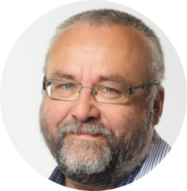
OTAKAR CERBA Assoc. prof. Otakar Čerba, PhD works at the Department of Geomatics (Faculty of Applied Sciences, University of West Bohemia, Plzeň, Czech Republic) and cooperates with Plan4all. He is focused on cartographic visualization of spatial data, Linked Data on the geographic domain and semantic issues of geographic data. He has been involved in many international projects such as Polivisu, Humboldt, SDI4Apps, SmartOpenData, Plan4all or ROSIE. Otakar Čerba is the member of the board of Czech Association of GeoInformation and the chair of the Commission on Maps and the Internet of International Cartographic Association

KRISTYNA CERBOVA Faculty of Education, Charles University in Prague. She works now as a communication manager in ROSIE project – Research and responsible innovation (Central Europe). Experience in education, languages, social sciences with a special focus on philosophy, history and archival science (2005-2007 digitalization activities in the National Archives of the Czech Republic). She works for other Plan4all H2020 projects such as LIVERUR or SIEUSOIL focusing mainly on smart agriculture topics.

Register now!

Invitation to the Webinar on Traffic Modeller

Register now!

Transportation systems are facing many changes caused by the introduction of disruptive technologies and services. Modeling has long been used to measure the impact of these and other changes (e.g. new policies, land development) on local traffic conditions. Given that the new age of mobility is upon us, the way we analyse our transportation network must change, too. Specifically, transport modeling should become more agile and experimental, leveraging new data sources and advanced technologies to deliver insightful results to decision makers.

Traffic Modeller (TraMod) is a server based solution for regional traffic modeling that provides insights for better mobility management by predicting future traffic based on simulated road conditions. In this webinar, participants will learn how TraMod uses different schemas to calculate traffic volumes in near real-time, and how calculations can be modified according to different user-defined scenarios e.g. adding a new lane or closing an existing one. Additionally, PoliVisu experts will explain what inputs are needed to run the tool, and what benefits one can expect to get from its use. The latter will be demonstrated using real-life case studies from three cities: Pilsen, Frantovky and Mechelen.

You will hear from: 

Why should I attend?

  • Learn about the benefits of traffic modeling
  • Discover best practice examples from different European cities
  • Find out how Traffic Modeller can support urban planning
  • Get a sneak peek at other PoliVisu tools and services

Even if you can’t join live, register now and we’ll send you a link to the recorded webcast so you can watch at your convenience.

Facebook    Twitter     Website

Plan4all as one of the 133 Participating Organizations of GEO


Dear colleagues, friends and business partners

We are delighted to let you know that the Plan4all association became one of the 133 Participating Organizations of the Group on Earth Observation (GEO). Due to the relatively short history of Plan4all, becoming a Participation Organization of the GEO is considered as a significant achievement and appreciation of our work and the work of our members.(See also the announcement at GEO’s website)

The main role of Participating Organizations is to Influence technical and policy decisions and contribute to the GEO Work Programme, and to benefit from the global community of Earth observation experts in sharing knowledge in the area of the GEO engagement priorities, namely regarding climate change, disaster risk reduction and the UN Sustainable Development Goals.

The key activities of Plan4all include utilisation of Earth observation data, sensor networks, crowdsourced/citizens science data and other geospatial data in various specialisms including spatial/urban planning, rural development, transport, environment, tourism and precision/autonomous agriculture.

By becoming a Participating Organization in the GEO, Plan4all hopes for better alignment of its activities with other members, sharing experience and contributing to the GEO community. The main  contribution of Plan4all should be in managing open geospatial data in an interoperable manner and capacity building towards the implementation of the latest GEO Strategic Plan 2016-2025. Plan4all is ready to contribute to the GEO governance and to the following Societal Benefit Areas (SBA) as defined in the GEO Strategic Plan 2016-2025:

  • Food Security and Sustainable Agriculture
  • Infrastructure and Transportation Management
  • Sustainable Urban Development
  • Biodiversity and Ecosystem Sustainability

Plan4all will contribute to these SBAs via hackathons, testing, validation and prototyping using the GEO data, metadata and services, generation of interoperable data and services in support of decision making by using state-of-the-art technologies including AI and big data technologies. A special attention will be given to the transport domain which should play a pivotal role in the GEO Work Programme.

We cordially invite you to join our activities by becoming a member of Plan4all or in any other way.

The Plan4all Committee, on behalf of the Plan4all association.

116th OGC Technical Committee meeting: Invitation to Digital Twins for Agriculture session

We would like to cordially invite you to join us at the upcoming Open Geospatial Technical Committee meeting organised by Agriculture DWG of OGC. The topic of this session will be Digital Twins for Agriculture. The sessions is scheduled on 15th of September 2020 between 14 00 CEST (8 00 EDT) and 16 00 CEST (10 00 EDT).

Tentative speakers

  • Karel Charvat (Plan4all) – EO4Agri White Paper
  • Peter Baumann (rasdaman GmbH.) – Datacubes for Optimizing Agriculture
  • Valantis Tsiakos (Institute of Communication & Computer Systems (ICCS) – An integrated EO-based toolbox for modernising CAP compliance monitoring and assessing respective environmental impact
  • Karel Jedlicka (UWB, Plan4all) – Calculation of agro-climatic factors from global climatic data
  • Emmanuel Mondon & Alexandre Cadain (Maxar/Anima) – Impact gaming leveraging EO (satellite, in-situ & 3D) applied to Agriculture Digital Twins
  • Walter Mayer (Progis) – Sustainable management of NATURE supported by time related satellite images, newest technology, local knowhow and global cooperation
  • Michal Kepka (BOSC) – SensLog – an interoperable solution for sensor data
  • Louis Cousin (Startinblox) – Inter-connecting geospatial and agricultural sectors: towards universal interoperability standards

You don’t have to be an OGC member to attend an OGC meeting. This session is open to anyone to attend and new voices are always welcome.


Background of the session

The agri-food chain involves multiple actors and stakeholders that produce and provide food and agricultural commodities to consumers. In addition to farmers there are farm suppliers, processors, transporters and market intermediaries. These actors make the agri-food chain efficient. Current agriculture is under pressure to produce more with less inputs and in smaller areas.

In order to provide solutions to all complex problems related to the agri-food chain, we need to better understand all processes and build an interoperable knowledge management system for each agriculture sector. 

EO4Agri analysis (https://www.eo4agri.eu/node/17, https://www.eo4agri.eu/node/18)  discovers a large number of overlapping needs for analysis of different stakeholder groups related to agriculture. On the other side there is a problem mainly in the farming sector that covers the cost of knowledge services and in this way supports sustainable business for all players in the IT for agriculture sector.  Last important fact is that new understanding of precision farming services can not only increase production, but produce products of higher quality, have fewer negative influences on the environment and also reduce different environmental risks.  It means that in such a case there could be interest of more stakeholders to improve knowledge  services.

With the new European Green Deal Initiative and new understanding of the Common Agriculture Policy in the Frame of Green deal and also on a global scale with SDGs  seems natural to think about building common solutions or sharing data among all groups of stakeholders. There are two important aspects for this to find common trust for data sharing and also implementation of FAIR Data Principles (Findable, Accessible, Interoperable, Re-usable). This could be supported by a new European strategy for data, but also by international initiatives like GEO/GEOSS. There is a need for discussion among the private and public sector about effective sharing of data and expenses. Due fact, that some services will be in public interest it seems to be natural that the public sector will cover part of expenses. 

The Commission is planning to initiate a ‘GreenData4All’, with focus on reviewing the Directive establishing an Infrastructure for Spatial Information in the EU (INSPIRE and Combine it with the Access to Environment Information Directive. As part of this will be the ‘Destination Earth’ initiative. 

“The ‘Destination Earth’ initiative will bring together European scientific and industrial excellence to develop a very high precision digital model of the Earth. This ground-breaking initiative will offer a digital modelling platform to visualize, monitor and forecast natural and human activity on the planet in support of sustainable development thus supporting Europe’s efforts for a better environment as set out in the Green Deal. The digital twin of the Earth will be constructed progressively, starting in 2021”.

In this context “Digital twins create a virtual replica of a physical product, process or system. The replica can for example predict when a machine will fail, based on data analysis, which allows to increase productivity through predictive maintenance.”

As part of this is intended “A Common European agriculture data space, to enhance the sustainability performance and competitiveness of the agricultural sector through the processing and analysis of production and other data, allowing for precise and tailored application of production approaches at farm level.”

The intention of session is to collect information about existing complex solutions, which could be base for future Agriculture Digital Twins and help to build  future knowledge management for global food security and better sustainability of agriculture production in varying climatic conditions and how remote sensing can support the UN Sustainable Development Goals and the European Green Deal.

Join the Weather Revolution Workshop hosted by OGC

Join OGC for the Weather Revolution Workshop, August 25, 10am EDT

The global weather sector is undergoing revolutionary change  driven by major advancements in sensing and data collection  via new satellite, in-situ and airborne observations. This revolution is accelerated by rapidly increasing industry contributions to observations and analytics, shifting the dynamics of weather prediction and forecasting, and outpacing government-owned and operated capabilities.

Join the OGC Weather Revolution Workshop to:

  • Better understand the technology trends relevant to weather prediction and forecasting
  • Discuss the implications of major growth in commercial weather observations and capacity
  • Consider possible futures for government, commercial data providers, and value adders
  • Identify areas of potential for experimentation, and public-private partnerships
  • Observe challenge areas in tech standards necessary to meet new and evolving requirements for hyperlocal weather

From this dialog among panelists and workshop attendees, OGC will be preparing a detailed report of findings and recommendations to help further stimulate the advancement of the global weather community.

This workshop is free to participants. Click to register.

COVID-19 INSPIRE Hackathon 2020: Call for Challenge Proposals DEADLINE EXTENDED

There is still enough time to submit your Challenge proposals for COVID-19 INSPIRE Hackathon 2020! New deadline for the proposals was set to 25 AUGUST.

The COVID-19 INSPIRE Hackathon will be already the 17th hackathon organised by the Plan4All association in cooperation with CCSS and other H2020 projects including SmartAgriHubs. It will be based on the traditional model of the INSPIRE Hackathon, which is not a single event, it’s a process that is designed to efficiently exploit the achieved results of previous hackathons on developing new innovations.

COVID-19 INSPIRE Hackathon 2020 develops and shares agri-food economy solutions to balance the imperatives of the present with the demands of the future. In COVID-19 Hackathon we will address next topics:

  • Facilitate access to data and services for an easier digital innovation in the agri-food sectors / 3-4 expected Challenges
  • Educating individuals from other sectors for being able to support agri-food businesses in the crisis / 1 expected challenge
  • Forecasting of regional food supplies, deviations and/or shortages / 3-4 expected challenges
  • Mobilising agricultural workforce for harvesting / 1 – 2 expected challenges
  • Regional matching of offer and demand for fresh produce in decentralised settings / 1 expected challenge

The hackathon is currently in its preparation stage related to challenge definitions. Therefore, we are looking for challenge proposals that will address the above topics.

The challenge proposal should include:

    • Title of the challenge
    • Name of the mentor***
    • Short description of the challenge (250 characters max)
    • Extended description of the challenge (cca 1800 characters)
    • The goal of the challenge

*** In the INSPIRE hackathons the mentors are mentoring the teams addressing a set of pre-defined challenges. The mentors coordinate the work in the teams, ensure the team communication, make sure the final reports of the team results before the end of the virtual hackathon are delivered, attend and support the final virtual event, coordinate the presentations dedicated to their team’s results, and making sure the results are presented at the final virtual event of the hackathon.

The Call for Challenge proposals on COVID-19 INSPIRE Hackathon is open until the 25 August 2020.

Please send your challenge proposals in pdf file to hana.kubickova@plan4all.eu

The COVID 19 INSPIRE hackathon is financed by the Smart Agri Hubs Project.

Media Partners of the COVID-19 INSPIRE Hackathon 2020:

COVID 19 INSPIRE Hackathon 2020: Deadline for The Call for Challenge Proposals Extended!

We are pleased to announce you that Plan4all proposal on COVID 19 INSPIRE Hackathon 2020 refering to SmartAgriHubs Open Call for solving issues raised by COVID 19 pandemic has been successfully accepted! 

The COVID 19 INSPIRE Hackathon will be already the 17th hackathon organised by the Plan4All association in cooperation with CCSS and other H2020 projects including SmartAgriHubs. It will be based on the traditional model of the INSPIRE Hackathon, which is not a single event, it’s a process that is designed to efficiently exploit the achieved results of previous hackathons on developing new innovations.

COVID 19 INSPIRE Hackathon 2020 develops and shares agri-food economy solutions to balance the imperatives of the present with the demands of the future. In COVID 19 Hackathon we will address next topics:

  • Facilitate access to data and services for an easier digital innovation in the agri-food sectors / 3-4 expected Challenges
  • Educating individuals from other sectors for being able to support agri-food businesses in the crisis / 1 expected challenge
  • Forecasting of regional food supplies, deviations and/or shortages / 3-4 expected challenges
  • Mobilising agricultural workforce for harvesting / 1 – 2 expected challenges
  • Regional matching of offer and demand for fresh produce in decentralised settings / 1 expected challenge

The hackathon is currently in its preparation stage related to challenge definitions. Therefore, we are looking for challenge proposals that will address the above topics.

The challenge proposal should include:

    • Title of the challenge
    • Name of the mentor***
    • Short description of the challenge (250 characters max)
    • Extended description of the challenge (cca 1800 characters)
    • The goal of the challenge

*** In the INSPIRE hackathons the mentors are mentoring the teams addressing a set of pre-defined challenges. The mentors coordinate the work in the teams, ensure the team communication, make sure the final reports of the team results before the end of the virtual hackathon are delivered, attend and support the final virtual event, coordinate the presentations dedicated to their team’s results, and making sure the results are presented at the final virtual event of the hackathon.

The Call for Challenge proposals on COVID 19 INSPIRE Hackathon is open until the 10 August 2020

Please send your challenge proposals in pdf file to hana.kubickova@plan4all.eu

The COVID 19 INSPIRE hackathon is financed by the Smart Agri Hubs Project.


Media Partners of the COVID19 INSPIRE Hackathon 2020:

SmartAgriHubs Central Europe Regional Cluster Tour – recorded webinar

the webinar from 7 / 7 / 2020

Organized by RC CE team
Martin Hirt Austrian Chamber of Agriculture (LKO – 
www.lko.at)
Karel Charvat, Sarka Horakova, Petr Uhlir, Jiri Kvapil (WIRELESSINFO – 
www.wirelessinfo.cz)

Now you can watch it online on Youtube:

SmartAgriHubs Regional Cluster Central Europe through LKO (www.lko.at) and WirelessInfo (www.wirelessinfo.cz)

Agenda:

  • SmartAgriHubs Regional Cluster Central Europe: Ambitions and Activities
  • Setting up a Digital Innovation Hub (DIH): Introduction of technology usable for building a digital hub: basic functionality, frontend users, backend, tools, applications
  • Building a community for DIHs using Hackathons: Use case od DIH – example on the Kampala Hackathon and usage of the DIH SmartAfriHub.com
  • Innovation Experiments: ‘Autonomous Vineyard Mower’ and ‘site-specific management in practice‘
  • SmartAgriHubs Open Call: An opportunity to join the community
  • Questions and Discussion: Your chance to interact with us

Join the SmartAgriHubs community
https://smartagrihubs.eu/register

COVID19 INSPIRE Hackathon: Call for challenge proposals

We are pleased to announce you that Plan4all proposal on COVID 19 INSPIRE Hackathon 2020 refering to SmartAgriHubs Open Call for solving issues raised by COVID 19 pandemic has been successfully accepted! 

The COVID 19 INSPIRE Hackathon will be already the 17th hackathon organised by the Plan4All association in cooperation with CCSS and other H2020 projects including SmartAgriHubs. It will be based on the traditional model of the INSPIRE Hackathon, which is not a single event, it’s a process that is designed to efficiently exploit the achieved results of previous hackathons on developing new innovations.

COVID 19 INSPIRE Hackathon 2020 develops and shares agri-food economy solutions to balance the imperatives of the present with the demands of the future. In COVID 19 Hackathon we will address next topics:

  • Facilitate access to data and services for an easier digital innovation in the agri-food sectors / 3-4 expected Challenges
  • Educating individuals from other sectors for being able to support agri-food businesses in the crisis / 1 expected challenge
  • Forecasting of regional food supplies, deviations and/or shortages / 3-4 expected challenges
  • Mobilising agricultural workforce for harvesting / 1 – 2 expected challenges
  • Regional matching of offer and demand for fresh produce in decentralised settings / 1 expected challenge

The hackathon is currently in its preparation stage related to challenge definitions. Therefore, we are looking for challenge proposals that will address the above topics.

The challenge proposal should include:

    • Title of the challenge
    • Name of the mentor***
    • Short description of the challenge (250 characters max)
    • Extended description of the challenge (cca 1800 characters)
    • The goal of the challenge

*** In the INSPIRE hackathons the mentors are mentoring the teams addressing a set of pre-defined challenges. The mentors coordinate the work in the teams, ensure the team communication, make sure the final reports of the team results before the end of the virtual hackathon are delivered, attend and support the final virtual event, coordinate the presentations dedicated to their team’s results, and making sure the results are presented at the final virtual event of the hackathon.

The Call for Challenge proposals on COVID 19 INSPIRE Hackathon is open until the 10 August 2020

Please send your challenge proposals in pdf file to hana.kubickova@plan4all.eu

The COVID 19 INSPIRE hackathon is financed by the Smart Agri Hubs Project.


Interactive Webinar Series on HTML Maps

The World Wide Web Consortium (W3C) and Open Geospatial Consortium (OGC), together with host Natural Resources Canada (NRCan), will present an interactive webinar series to make HTML Maps a first class citizen of the Web. The W3C/OGC Joint Workshop Series on Maps for the Web will be a distributed, online meeting of developers, cartographers, policy makers, and other people with an interest in the future of Web standards relating to use of spatial information to display maps on the Web.

Register now to hold your place for the workshop series taking place over ten days, starting 28 September to 9 October 2020. Submit a position paper by 15 July 2020 if you would like to be considered to give a presentation.

More information available at https://www.w3.org/2020/maps/call-for-participation#position-statements