EUXDAT Webinar Series – Pilot’s Session

Did you miss another webinar held in the frame of EUXDAT Webinar Series? No worries, we have a recording for you so that you can watch it now!

Please, helps us to get your opinion on the EUXDAT project.by filling in the questionnare.

Webinar Agenda:

EUXDAT relevance towards Farm to Fork and Towards a Green Cap. Karel Charvát (CoO)
The Farm to Fork Strategy, s to address the challenges and accelerate the transition to sustainable food systems, to ensure that the economic, social and environmental foundations of food and nutrition security are not compromised for current and future generations. To be possible implement challenging goal of Farm Fork Strategy, there will be necessary to introduce effective knowledge management. We will share our experience, how new technologies can help with implementation of such knowledge management system.

Crop Climate Risk Analysis, Monitoring, and Prediction. Nicoletta Addimando, Christoph Ramshorn (meteoblue)
We combine local climate data with information on a crop’s susceptibility to drought and frost in different growth stages. This allows us to analyse which crops are best suited for a location as it is affected by climate change. We can also monitor crop weather risks as the current growing season unfolds and predict crop weather risks for 5 to 14 days.

Discussion and feedback analysis, Karel Charvát (CoO), Jorge Lopez (ATOS)

Invitation to the Webinar on Business Plans

Register now!

The COVID-19 INSPIRE Hackathon 2020 Webinar Series reaches its end already on Monday 26th October with the Webinar on Introduction to Business Plans.
Most people want to start their business just by jumping in and doing «it». If they would dedicate some time to the planning and forming a sensible business plan, they would save both time and money. So let’s take a look at how they are formed in ESA BIC Prague. 

Do you want to learn How to formulate a clear story in your business plan? What are the most common mistakes that you can avoid? How to write your business plan for you and the reader? Then do not hesitate to register!

Register now!

Agenda:

  • What is the Business plan?
  • Lean canvas
  • TRL
  • SWAT an risks
  • Market analysis
  • Gantt chart
  • Conclusion

You will hear from


Final Webinars of the EUXDAT Project “The EUXDAT e-Infrastructure”

Yesterday, a final webinar series of the EUXDAT project started with the webinar dedicated to The EUXDAT e-Infrastructure. In case you missed it, we have its recording so you can watch it now!

Please, helps us by filling in the questionnare to get your opinion on the EUXDAT project.

The agenda of the webinar:

Introduction of Series EUXDAT Webinars. Karel Charvát (CoO)

Introduction to series of Webinars, purpose of  Webinars and introduction of EUXDAT questionnaire

Green Deal, Destination Earth and EUXDAT. Nieto De Santos, Francisco Javier (ATOS)

This webinar will describe the main features of the EUXDAT e-Infrastructure and will analyse the main topics defined in the last initiative of the EC, focusing on the Green Deal. We will explain how EUXDAT can contribute to the EC vision and which features might be used by researchers and practitioners, in order to facilitate the implementation of the proposed ideas and concepts

The EUXDAT End user Platform. Anne Haugommard, Fabien Castel (ATOS France)

In this session we will present the EUXDAT platform features offered in the web platform. An overview of the platform components and hosting e-infrastructure architecture, the data catalogue, the development environment with notebooks to develop new value-added algorithms using data connectors and geoprocessing libraries.

The orchestrator, parallelization, monitoring, and accounting in EUXDAT. Jesus Gorroñogoitia Cruz,  Paolo Marangio (ATOS Spain)

This webinar presents the architecture implemented for managing the underlying infrastructure of EUXDAT, so it is possible to use Cloud and HPC resources in the Agriculture domain easily. It will present the different components involved (orchestrator, monitoring, accounting, Service Level Agreements manager) and how they are connected. In the webinar we will explain the features provided and how they can be used. We will also explain how we parallelized one of the EUXDAT scenarios and how it is possible to run it through the described components.

Parallelizing with Python-MPI. Jose M. Montañana (HLRS)

The amount of data available for Geoprocessing applications has been increasing exponentially during the last decades, as well as the size of the problems to solve, which requires increasing the computation capabilities. In order to achieve it and reduce computation time, supporting tools have been developed to ease the distribution of tasks among multiple processing nodes. In this session, we focus on an introduction to how to use Python-MPI. It allows parallelizing existing applications for its execution on HPC and on Cloud.

Discussion and feedback analysis. Karel Charvát (CoO), Jorge Lopez (ATOS)

 

Webinar on A Map WhiteBoard for Collaborative Map-Making

Let us cordially invite you to the webinar, where the “Map Whiteboard for Collaborative Map-Making and Data Capture” will be presented. The working title of their effort is a “Map Whiteboard” and the transport and storage for data is a JSON based format called “Map Compositions” that draws on the early work of Web Map Context documents, but that extends them with 20 years worth of added features. This webinar related to challenge No. 5 of COVID-19 INSPIRE Hackathon 2020 is scheduled on 22nd October at 1PM CEST. Join the webinar to learn more about this extremely useful tool that is being developed in collaboration with BOSC and AVINET. Do you want to learn more? Then do not hesitate to join us on Thursday!

Register now!

Agenda of the webinar:

  • Map Compositions format
  • Collaborative Map-Making – Introduction to map compositions, Example of composition structure
  • Introduction to map WhiteBoards
    • Authorization and ownership
    • Layer management
    • Feature synchronization

You will hear from 

Final EO4Agri Workshop

This is the final workshop of the EO4AGRI project, which is planned as an open meeting to present the final EO4AGRI Strategic Research Agenda and recommended Roadmap towards improving the European capacity for operational agriculture monitoring based on information derived from Copernicus satellite observation data and through the exploitation of associated geospatial and socio-economic information services.

The workshop will be split into two sessions of around 1.5 hours each. The first section is oriented to researchers, developers, scientific communities, etc, and will be focused on the methodology, user requirements, and gap analysis processes developed during the project in order to get the results that are gathered in the EO4AGRI Strategic Research Agenda and Roadmap that will be presented during the second session (which is mainly targeted to policymakers, public administrations, etc).

Additionally, each slot will be combined with a Coffee table where participants will be able to interact with the speaker and discuss hot topics of that slot.

AGENDA

28/10/2020 || 14:00 CET : Technical insights on the use of Earth observation for agricultural applications

  1. Overall event concept
  2. EO4Agri – Project overview
  3. User Requirements and Gap Analysis for the use of Earth observation data in agricultures
  4. Technical landscape
  5. Methods for Agriculture Applications
  6. Infrastructure & Software
  7. EO4AGRI catalogue.
  8. Q&A

29/10/2020 || 14:00 CET: EO4AGRI Strategic Research Agenda and Roadmap

  1. Overall event concept.
  2. Project Introduction
  3. Earth Observation for Agriculture Strategy and Implementation of the Green Deal
  4. EO4AGRI Strategic Research Agenda for Earth Observation in Agriculture in  Europe beyond 2020
  5. EO4AGRI Policy Roadmap – concise guidelines for EO in agriculture for CAP post-2020
  6. Q&A

Calculation of agro-climatic factors

Agenda of the webinar:

  • Agro-climatic factors and utilization in agri-food sector
  • Datasets available for calculation of factors
  • Datasets of ground measurements
  • Calculation methods of selected factors
  • Process of comparison of global datasets and ground measurements

You will hear from 

Using the Atlas of Best Practice to Fight COVID-19 in Rural Areas

This webinar scheduled on 20th October at 9 AM CEST will present three challenges that use the Atlas of Best Practice to present solutions to problems that arise in connection with Covid-19 in various areas. These challenges are Atlas of Regional Specialities, Atlas of the Best Practices – Polirural cases and Atlas of Social Enterprises. At the same time, it offers interesting examples of how to eliminate these negative impacts and  cope with the pandemic using innovations and lessons learned from across Europe. 

Register now!

Agenda of the webinar:

  • Welcome from the moderator (Bente)
  • Hackathon introduction and quick overview of 3 challenges: similarities and differences
  • Atlas of the Best Practices (the Enabling project) – common technical platform for presentation of outputs of individual Challenges
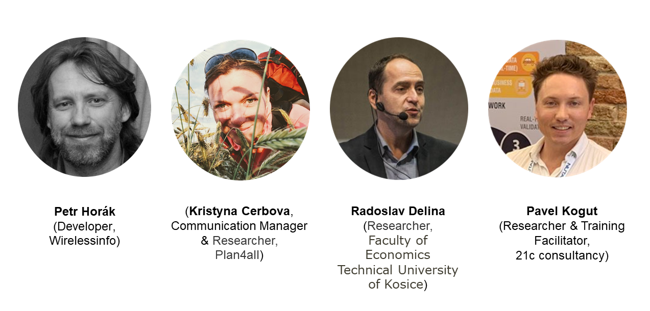
  • Ch. 2 presentation (Kristyna, Petr)
    • goals, the Atlas prototype – Regional Specialities, Expected outputs, brainstorming 
  • Ch. 6 presentation (Pavel, Petr)
    • goals, the Atlas prototype – Polirural, Expected outputs, brainstorming
  • Ch. 12 presentation (Radoslav, Petr)
    • goals, the Atlas prototype – Social Enterprises, Expected outputs, brainstorming
  • general Q&A
  • Conclusion

You will hear from 

Rural Attractiveness Visualization

Agenda of the webinar:

  • Introduction to the challenge #4 → Goals, tasks, working groups
  • About Polirural project: Overview over the approach and aims of the project & presentation of the 12 pilot regions
  • Rural Attractiveness: General understanding of rural attractiveness / Principles of searching of homogeneous regions (rural attractiveness index, clustering)
  • The web map application: Features and functionalities / Brief technical details / Input data
  • Ideas for potential improvements of the map application

You will hear from: