SIEUSOIL Press Release

Soil health has raised the last few years a significant share of concerns. Investing in research is a key to gathering the best data and developing the best solutions for sustainable soil management.

Soils are essential for all life-sustaining processes on earth. However, they are facing several pressures and are also heavily affected by climate change and erosion.

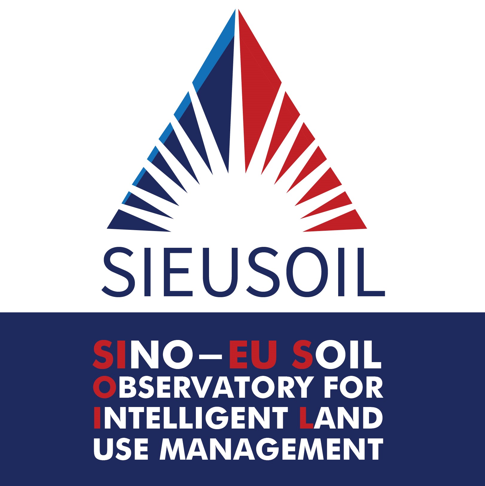
The SIEUSOIL research project which is supported by the Research and Innovation programme HORIZON 2020, aims to develop sustainable soil management practices based on a harmonised land information system suitable for diverse climate and operation conditions along different EU and China locations.

The project activities in the first 18 months of its lifetime have been successful. Collaboration has been established with key global stakeholders, including the Food and Agriculture Organisation, the International Soil Reference and Information Centre, the Joint Research Center and the European Environment Agency.

The original plan foreseen for the Eurasian Soil Platform development has been outperformed so far. The impact of the SIEUSOIL’s results in terms of the Web Observatory platform is in some areas even greater than foreseen. The data model developed with the SIEUSOIL’s and FAO resources will not only be used for the purposes of the Eurasian soil platform. The developed data model has world-wide impact.

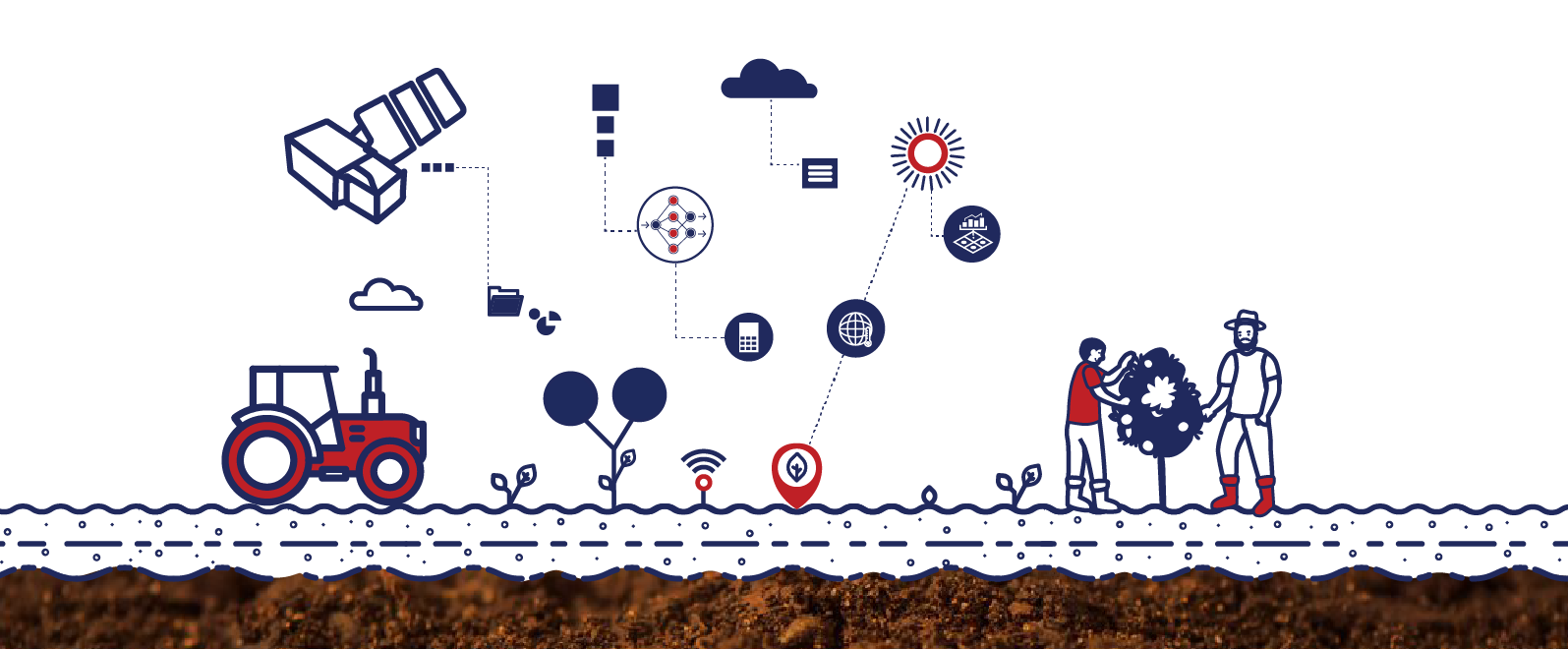
Earth observations-derived biophysical parameters have been made available to the pilot activities in the EU and China, while a set of biophysical quality indicators for soils and crops have been defined and their methodology established.

Accurate prediction models for soil and soil physical parameters have been validated and Management Zone Maps and variable rate fertilization maps have been obtained in certain pilot farms. Prediction of Yield Productivity Zones with satellites’ support and their evaluation using farm machinery measurements seem to have gain a huge attention in the scientific community.

Moreover, certain parameters have been selected for the Land Suitability Analysis tool and its use in the pilot areas.

The pilot-scale Decision Support System (DSS) specifications and a prototype test version have been prepared. The connections among the different components were identified, as well as the dependencies on the external sources of data.

The proposed EU mission “Caring for soil is caring for life” is key for meeting the ambitions of the “Green Deal”, notably the Farm to Fork and Biodiversity Strategy. SIEUSOIL is totally in line with this mission which is the EU’s strategic research agenda regarding soils for the years to come.

***

SIEUSOIL is coordinated by Professor Dimitrios Moshou (dmoshou@auth.gr) of the Aristotle University of Thessaloniki that leads the consortium of 23 partners, 16 based in Europe and 7 in China.

Final EO4Agri Workshop

This is the final workshop of the EO4AGRI project, which is planned as an open meeting to present the final EO4AGRI Strategic Research Agenda and recommended Roadmap towards improving the European capacity for operational agriculture monitoring based on information derived from Copernicus satellite observation data and through the exploitation of associated geospatial and socio-economic information services.

The workshop will be split into two sessions of around 1.5 hours each. The first section is oriented to researchers, developers, scientific communities, etc, and will be focused on the methodology, user requirements, and gap analysis processes developed during the project in order to get the results that are gathered in the EO4AGRI Strategic Research Agenda and Roadmap that will be presented during the second session (which is mainly targeted to policymakers, public administrations, etc).

Additionally, each slot will be combined with a Coffee table where participants will be able to interact with the speaker and discuss hot topics of that slot.

AGENDA

28/10/2020 || 14:00 CET : Technical insights on the use of Earth observation for agricultural applications

  1. Overall event concept
  2. EO4Agri – Project overview
  3. User Requirements and Gap Analysis for the use of Earth observation data in agricultures
  4. Technical landscape
  5. Methods for Agriculture Applications
  6. Infrastructure & Software
  7. EO4AGRI catalogue.
  8. Q&A

29/10/2020 || 14:00 CET: EO4AGRI Strategic Research Agenda and Roadmap

  1. Overall event concept.
  2. Project Introduction
  3. Earth Observation for Agriculture Strategy and Implementation of the Green Deal
  4. EO4AGRI Strategic Research Agenda for Earth Observation in Agriculture in  Europe beyond 2020
  5. EO4AGRI Policy Roadmap – concise guidelines for EO in agriculture for CAP post-2020
  6. Q&A

Questionnaire on Adoption of AgriSemantics for Food Security

Dear GODAN Partner,

Dr. Chris Baker from the New Bunswick University and Senior Data Scientist, and machine learning expert Dr. Brett Drury are conducting research on the adoption of AgriSemantics for food security. As part of this research they have developed a questionnaire and need the input of subjects who – like many of GODAN’s partners – work with agricultural data.

Please share the link with your networks, and with anyone you know may be interested in taking part: https://forms.gle/SsiKE2WF8si31aFK7

The results will form part of an upcoming publication on the topic. Find out more below.

Introduction

Agrisemantics allows the meaning of specific concepts in agricultural data to be clearly defined and understood by organisations who consume or produce data in the agricultural supply chain. This can be achieved with publicly available resources such as taxonomies, ontologies and thesauri which when created for agriculture are collectively referred to as Agrisemantics. These resources have been available for at least the last twenty years. The adoption of these resources by the agricultural sector has been limited and at best uneven in quality or performance. This study is designed to understand why the adoption of Agrisemantics is stymied.

Project Aims

The main aim of this project is to gain an understanding of the commonalities of adoption of Agrisemantics of all communities. From these common themes we wish to identify the drivers and roadblocks to the adoption of AgriSemantics in private industry as well as possible blindspots in the current development of publicly available resources. A secondary aim of this study is to publicise Agrisemantics to decision makers. The current COVID crisis has exposed the fragility of Agricultural Supply Chains. Agrisemantics facilities interoperability and has the potential to distribute the risk by allowing the ad-hoc integration of small suppliers into larger supply chain systems. This distribution of risk removes single points of failure in Supply Chains which are created by small numbers of large suppliers. However many decision makers are unaware of this. It is hoped that this study will raise awareness how Agrisemantics can benefit Agricultural companies.

Methodology

The research methodology uses in person interviews and a questionnaire to elicit opinions about:

  1. The adoption of AgriSemantics in private industry and the public sector
  2. The flaws in current AgriSemantic public resources.
  3. How does funding impede or enable AgriSemantic projects
  4. Is there any incentive for knowledge transfer from publicly funded projects to private industry.
  5. Is there any pressure from government agencies to force private industry to adopt standards.
  6. The measurable benefit of semantics resources and technologies to the targeted goals of researchers and business decision makers.

The interview process is a free form interview where the interviewee expresses their opinion about the core themes as well issues that they think is important.

The study is interested with interviewing people with the following profiles:

  1. Individuals who approve funding for AgriSemantic projects
  2. Individuals who have served on committees that set funding criteria for Agriculture
  3. Innovation projects
  4. Technical people who work with data integration on day to day basis
  5. Project Managers
  6. CEOs of AgriBusiness Companies
  7. NGOs who produce publicly available semantic resources
  8. Academics
  9. Technical professionals serving on committees tasked with the development of standards supporting interoperability.
  10. Agribusiness entrepreneurs
  11. Supply chain professionals

Study Outputs

The study aims to produce a high quality policy paper which seeks to influence all levels of the Agrisemantic, and Agricultural communities, and put Agrisemantics front and centre in the current debate about food security and stability of the food supply chain.

Dynamic Visualisations for Analysing Road Accidents and Traffic Conditions

REGISTER HERE

Modern data analysis often requires special techniques for handling complex data structures. Interactive graphs can provide insights into multivariate datasets by communicating the key aspects in a more intuitive way than isolated bar charts or static maps.

This webinar will present the WebGLayer tool as an enabler of dynamic visualisations that make spatio-temporal patterns, relationships and trends in the underlying data more apparent. Using case studies from Pilsen (CZ) and Flanders (BE) we’ll show how policy makers can use WebGLayer to address local problems such as traffic congestion and road accidents.

Others who might find this event useful include web developers, Open Source enthusiasts, social scientists, journalists and civil society groups interested in exploring social issues through data visualisations.

You will hear from:

Even if you can’t join live, register now and we’ll send you a link to the recorded webcast to watch at your convenience.

PoliRural Newsletter No.3

The PoliRural project has issued the third newsletter from June 2020 with the following content:

  • Population and Rural Attractiveness, a Sample System Dynamics Model by Antoni Oliva Quesada (22sistema)
  • Coronavirus vaccine being developed at MIGAL – Galilee Research Institute, Israel by Prof. Uri Marchaim (MIGAL – Galilee Research Institute)
  • PoliRural Innovation Hub by Petr Uhli (Czech Center for Science and Society)
  • Building Synergies: SHERPA – Rural Science-Society-Policy Interfaces by Roxana Vilcu (Communications Officer for SHERPA)

For full text of the newsletter please go to https://polirural.eu/newsletter/3/.

EO4AGRI online workshop “Galileo, EGNOS, and Copernicus for Agriculture”

In Europe, we have two major space based programs, Galileo and Copernicus. Combining the navigation or positioning tools of Galileo and the Earth observation data and services of Copernicus for improved food security and agriculture in general is what we address in this webinar.

Hence, it is obvious that there is a great untapped potential in combining positioning data from Galileo and EGNOS with Earth observation data for agriculture. Additionally, the Covid19 virus is unfortunately not only harming our health, it is also jeopardizing our food security. It is evident that we need to pump up our efforts to combine all the resources and knowledge we have to secure a continued good life, not only for Europeans, but for our entire planet.

Students, researchers, data analytics, participants in European, national and international projects, developers, service and application developers will learn more about Galileo, EGNOS and Earth Observation (Copernicus programme) with our speakers:

  • María-Eva Ramírez works at INECO as GNSS Expert, working as part of SpaceOpal Team at the GSC (European GNSS Service Center) for Galileo Adoption and Market Development, focused mainly on EGNSS Applications on Agriculture and Geomatics domain.
  • Sofía Cilla, works as Service Adoption Manager with the goal of promoting EGNOS usage in the different GNSS user communities (eg. aviation, rail, maritime, agriculture and geomatics) today and those that may come in the future.
  • Joaquin REYES GONZÁLEZ is Market Development Technology Officer at GSA working in the professional high-precision market on EGNOS and Galileo, focused on Agriculture topics.
  • David Kolitzus is a Senior Expert and Project Manager with an IT and a remote sensing expertise at GeoVille.
  • Bente Lilja Bye has been a member of the GEO community since 2004, engaged both as representative in the GEO plenary, in committees and contributing to the GEO Work Programme, and currently represents Norway on the GEO Programme Board. Bente runs a small research and consultancy company, BLB, focusing on transforming Earth observation data to information and knowledge for societal benefit.

Join us using the link below on Tuesday 26th May, 15:00 CEST

Live Webinar on How to Overcome Data Challenges in Transport Policy Making

Live Webinar

How to overcome data challenges in transport policy making? Lessons from the PoliVisu pilots

Register at https://zoom.us/webinar/register/WN_sbaLolXgQ6yIyU1xYb6XOQ

In this webinar we’ll discuss various data challenges experienced by cities, with a particular focus on three PoliVisu pilots: Ghent, Flanders and Issy-les-Moulineaux. Representatives of local and regional administrations will speak about the issues they faced and how they addressed them using the PoliVisu solution.

This webinar is open to everyone. That said, people who would find the event especially useful are public sector staff who either work with data directly (analysts, data officers etc.) or depend on it to make informed decisions e.g. department managers, councilors, mayors, CEOs, elected officials.

You will hear from:

Why should I attend?

  • Learn about data challenges that cities in Europe are facing
  • Discover ways to overcome them using best practice from the PoliVisu pilots
  • Find out why PoliVisu was created and how it can help your city make smarter policy decisions
  • Get a sneak peek at other PoliVisu services and future events

Even if you can’t join live, register now and we’ll send you a link to the recorded webcast to watch at your convenience.

Challenge #4: Traffic Modelling from web browser – use case of Františkovy Lázně

Team: Daniel Beran, Jan Blahník, Petr Trnka, Eva Podzimková, Zuzana Soukupová, Jan Sháněl, František Kolovský, Jan Šťastný, Jan Martolos a Karel Jedlička, supported by Polivisu and DUET H2020 projects.

The goal of our team is to demonstrate how interactive traffic modelling can improve traffic planning in any city. The demonstration consists of gathering available data and deploying a Traffic Modeller App of Františkovy Lázně (city of 5K people in Czechia).

Traffic Modeler (TraMod) is a tool for transport modeling developed in collaboration between traffic engineers, IT and GIS specialists. It can be fully implemented in a server environment with an application programming interface (API) for mobile and web applications. This creates an opportunity for a city or a region’s government representatives to test various traffic scenarios within seconds without a need to install and learn how to use desktop traffic modelling software or contacting traffic engineers every time a new roadwork appears in the region.

Our workflow for Dubrovnik Hackathon is as follows:

  • gather sufficient data about traffic network and about simulated traffic generators,
  • calculate the traffic model and import it into a spatial database, where it can be accessed by our traffic modeler.
  • this model will then be used for modeling specific traffic scenarios via traffic modeler’s Application Programming Interface (API) (see the image below)

The final step is to develop a web Graphical User Interface (GUI) similar to one already in action for the PoliVisu pilot city – Pilsen (see the image below or watch a video of TraMod in action). This application allows users to calculate various traffic scenarios (i.e. change free flow speed/capacity of road segment) in near real time via only a web browser with network connection.

Challenge #6: Integrating INSPIRE with Citizen Science and Earth observations authentication systems

Mentors: Andreas Matheus, Hector Rodriguez

The scope of the challenge is to enhance your geospatial and/or INSPIRE enabled web-based or mobile application so as to connect  to eitherCitizen Science and/or Earth Observation data. More specifically, the challenge will focus on improving accessibility to protected resources while also enabling their direct consumption and utilisation by third party applications. 

For enhancing your existing web-based or mobile application to contribute to citizen science and crowdsourcing activities within the LandSense Citizen Observatory (https://landsense.eu), you would need to implement OpenID Connect into your application that is able to interact with the LandSense Authorization Server (https://as.landsense.eu/). The LandSense Authorization Server is a core output from the project and more details can be accessed from the public deliverable “LandSense Engagement Platform – Part I”.

In order to initiate registration, you can choose to use a static registration page or leverage the RFC 7591 compliant dynamic client registration endpoint. A registered application can then use the LandSense federation including login options from Google, Facebook or eduGain (approx. 2800 University and Research organizational logins). The collection and processing of any personal data is compliant with the EU’s General Data Protection Regulation (GDPR). However, when registering the application, you can control the degree of personal information you need: A user can be simply authenticated, labelled with a cryptoname or identified with personal information. 

In order to contribute to Citizen Science with your application, you will need to interact with the LandSense platform. Additionally, you may use an OGC SensorThings API for accessing existing data or inserting new observations from the  SCENT Harmonisation Platform (http://scent-harm.iccs.gr/). The latter includes an OAuth2 Resource provider that is also integrated within the LandSense federation. 

Last but not least, you will have the opportunity to connect also to NextGEOSS Single Sign On (https://nextgeoss.eu/platform-services/user-management/) and integrate within your application protected EO resources or utilise existing applications. Additionally, details on how to interact specifically with NextGEOSS User Management system are available from here: https://github.com/ec-nextgeoss/nextgeoss-integration-guide-um

As a participant in this challenge, you should be familiar with OpenID Connect / OAuth2 principals and the developer of the application that you bring to enhance. You will learn during the hack-a-thon how to integrate a OpenID Connect library like HelloJS into your web-based application and how to setup the library to connect to a 3rd party OpenID Connect Authorization Server.

Yes, I want to register for Challenge #6!

Challenge #8: Improve interoperability between methods for sharing in-situ and citizen-sourced data

The goal of the challenge is to make available datasets provided by H2020 Citizen Observatories as well as other citizen-science projects and initiatives, through the use of SensorThings API standard and develop and test tools to provide combined visualization of data coming from different sources. This involves also sharing of environmental measurements coming from different IoT devices and in-situ monitoring sensor networks, aiming to establish combined use of data and services among different platforms towards improved environmental monitoring. 

More specifically, most of the latest projects and initiatives rely their implementation on the use of different standards like OGC Sensor Observation Service (SOS), that defines a web service interface which allows querying observations, sensor metadata, as well as representations of observed features, or more frequently used standards such as the OGC Web Feature Service. On the other options, a lot of initiatives is defining own specifications respecting needs of current projects. Integration of such data is connected with additional effort spent on development of specific translators.

Such standards (i.e. OGC SOS)  are more applicable to in-situ sensors that have a fixed location, and thus not fitting the citizen science paradigm that involves monitoring of an environmental phenomenon with different portable sensors at different locations (lack of flexibility between the location and the sensor as well as between the user and the sensor). Moreover, the implementation of requests such as the extraction of latest observations from sensors cannot be executed in an efficient or scalable way. 

Thus, the key use cases under this challenge are described as follows: 

  1. Implementation of “data translators” that will facilitate the conversion of resources exposed from OGC SOS and WFS to SensorThings API compatible schemas. In particular, the SensorThings API implementation provided by the SCENT Citizen Observatory shall be used as a reference application where the resources from other projects will be ingested. 
  2. Visualisation of resources exposed by SensorThings API through dedicated interfaces 
  3. Integration of different datasets of environmental monitoring by utilization of special “data translators”.
Yes, I want to register for Challenge #8!