
This is a description of Challenge No. 3 of the Kampala INSPIRE Hackathon 2020 led by Dmitrij Kozuch. For more information about Dmitrij see the link.
The main goal of the challenge is to do a research on available data sources, that could be used in defining the land use in Africa. That could be data about land cover, protected areas, urban areas, topographic geographic databases, transport infrastructure, points of interest, crowdsourced data etc.
After the research is done the algorithm how to define land use type based on the collected data will be created. As a result ideally the land use map of Africa will created.
As an additional extra tasks could be seen integrating the data into open-source solution SensLog (by implementing appropriate SensLogConnector), as well as extracting some important information (for example, about land cover) from satellite imagery.
The participants of the team will work on various tasks that could, depending on the interest, include:
- Research on available data sources (about land use, land cover, borders of administrative regions/municipalities, topographic databases, protected areas etc…)
- Collecting data (crowdsourcing, using satellite images to do automatic classification or manual tracing)
- Working on integrating raster data sources into OpenLandUse dataset (for instance, some important datasets such as „South African National Land Cover“ , „S2 PROTOTYPE LAND COVER 20M MAP OF AFRICA 2016“ are available just in raster format, as well as results from automatic classification are typically available as rasters)
- Exploring , wether Hierarchical INSPIRE Land Use Classification System(HILUCS) is a good classification system is suitable for Africa, and if not what is the better alternative.
- Exploring how to define land use based on available data. Presumably it will be mostly data about land cover and its change available in raster format
In case of interest in one of those abovementioned tasks, please, don‘t hesitate to contact me at dmitrii@seznam.cz
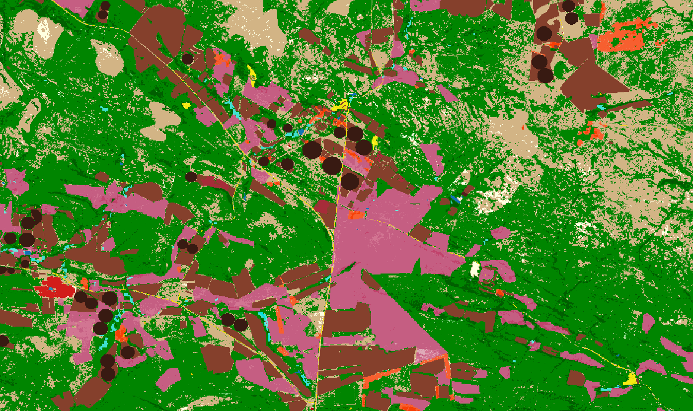 lllustrational image – sample of „South African National Land Cover“ dataset, that was produced based on automatic classification of satellite imagery for the year 2018 and has spatial resolution 20 meters. Would be good to integrate it into the OpenLandUse for Africa dataset.