
 This is a description of challenge No. 7 of the Kampala INSPIRE Hackathon 2020 led by Karel Charvát, Jiri Kvapil, Dmitrij Kozuch, Hana Kubickova, Jan Chytry, Lilian Ndungu. For more information about mentors see the link.
EO4FoodSecurity challenge is supported by EO4Agri project http://www.eo4agri.eu/.

EO4AGRI main target is to prepare the European capacity for improvement of operational agricultural monitoring from local to global level based on information derived from Copernicus satellite observation data and through the exploitation of associated geospatial and socio-economic information services.
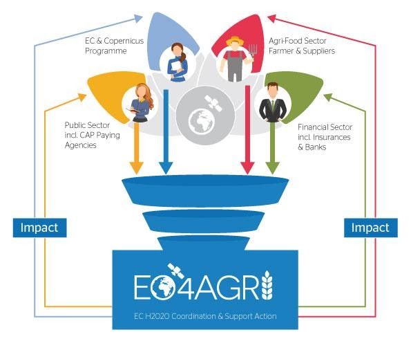
Thus, EO4AGRI enlarges and further systematizes knowledge about Copernicus for agriculture and identifies gaps in the utilisation of EO in AgriFood, public services and needs of financial sector, including international policy and coordination programmes.
-
- EO4AGRI assists the implementation of the EU Common Agricultural Policy (CAP) with special attention on the CAP2020 reform, requirements of Paying Agencies and Integrated Administration and Control System (IACS) processes.
- EO4AGRI works with farmers, farmer associations and agro-food industry on specifications of data-driven farming services. They focus on increasing the utilization of EC investments into Copernicus Data and Information Services (DIAS).
- EO4AGRI addresses global food security challenges coordinated within the G20 Global Agricultural Monitoring Initiative (GEOGLAM) capitalizing on Copernicus Open Data as input.
- EO4AGRI assesses information about land-use and agricultural service needs and offers to financial investors and insurances and the potential added value of fuelling those services with Copernicus information.
Challenge 7 will be focused on the third topic dedicated to Food security and mainly on EO and food security in Africa. There will be two Topics:
- Ideation focused on the discussion of Potential of EO for Africa from point of view of African Stakeholders
- Hackathon or Datathon with focus on testing different methods of automatic classification/interpretation of satellite images from Africa using cloud tools including AI.
Potential of EO for Africa
This part will be a continuation of the last year Nairobi INSPIRE Hackathon. There were identified next areas, where EO can help to African Agriculture:
Soil management can benefit a lot from earth observation. Modelling erosion would help avert loss in soil fertility.
- Near real-time crop monitoring data would be very helpful to farmers, because it could enable them to identify remedies to crop failures in good time and avoid losses.
- The same data could assist government plan in advance in terms of addressing the anticipated deficit in food stock hence avert cases of food shortage.
- Earth Observation will also be very important in prediction analysis in the agricultural sector. This will permit African Agriculture to be economically and technically efficient. It can also permit African countries to specialise in different sectors, therefore, develop trade agreement..
- In highlighting the suitable areas for different agricultural practices and the hotspots of food insecurity. As any other thematic area, agriculture has a geographic dimension that can only be captured and revealed by accurate and dynamic earth observation data.
- Earth observation can be used to assess risks/threats to sensitive ecosystems like forests and wetlands. Forests and wetlands areas are known as contributors to food security, particularly when sustainably used.
- EO in particular whether data and biomass can be used to generate index-based services for Banking and insurance such as Weather and Yield index
During the virtual phase of Hackathon, we plan to discuss this issue and collect additional ideas. We will also discuss, how could be guarantee better access for African Comunity to EO related services.
Automatic classification/interpretation of satellite images from Africa using cloud tools including AI
Web-based JupyterHub environment exposing a set of powerful Python-based spatial data visualisation, analysis and manipulating tools. These are GeoPandas, eo-learn and many more allowing spatial and satellite imagery analysis, while using your web browser and working on a remote JupyterHub server. Apart from that, set of other third-party tools is also available on the server- just mentioning some of them – GDAL, Orfeo Toolbox, GRASS, QGIS API, etc. Furthermore, users can even use custom developed data processing tools, visualisation tools and publication tools – mostly LayMan and SensLog.
Layman is a tool to facilitate the management of spatial data, SensLog is focused on sensor data manipulation. Thanks to QGIS plugin, easy publication of map compositions as map services is available.
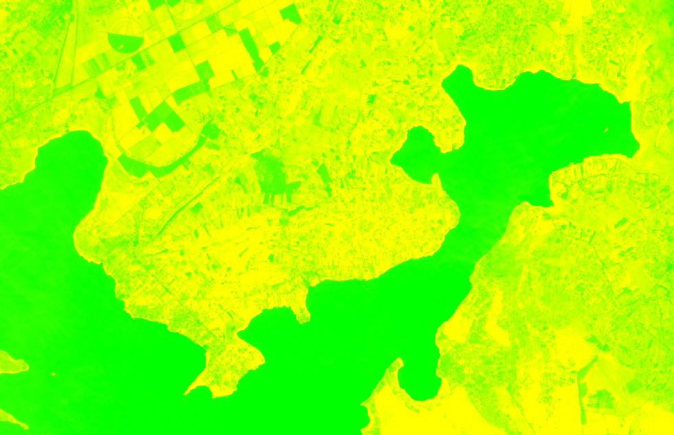
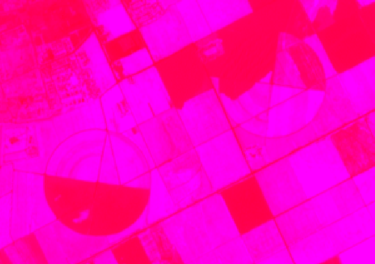
Sentinel 2 images of target locality will be available to Hackathon participants for satellite imagery classification workflows. Images are available in L2A level of processing, i.e. after atmospheric corrections that we have already calculated for your convenience.
 Hackathon participants can utilize tools for unsupervised or supervised classifications using both statistical and neural network-based methods as well as the calculation of various vegetation or other indices, try to estimate the type of land cover, classify the type of crops, etc.
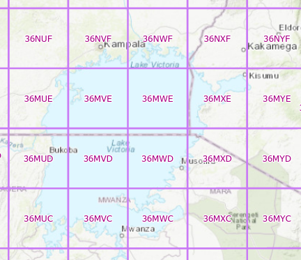
Images covering northern and eastern parts of Lake Victoria (36NVF, 36NWF, 36NXF, 36MXE and 36MXD – see below)
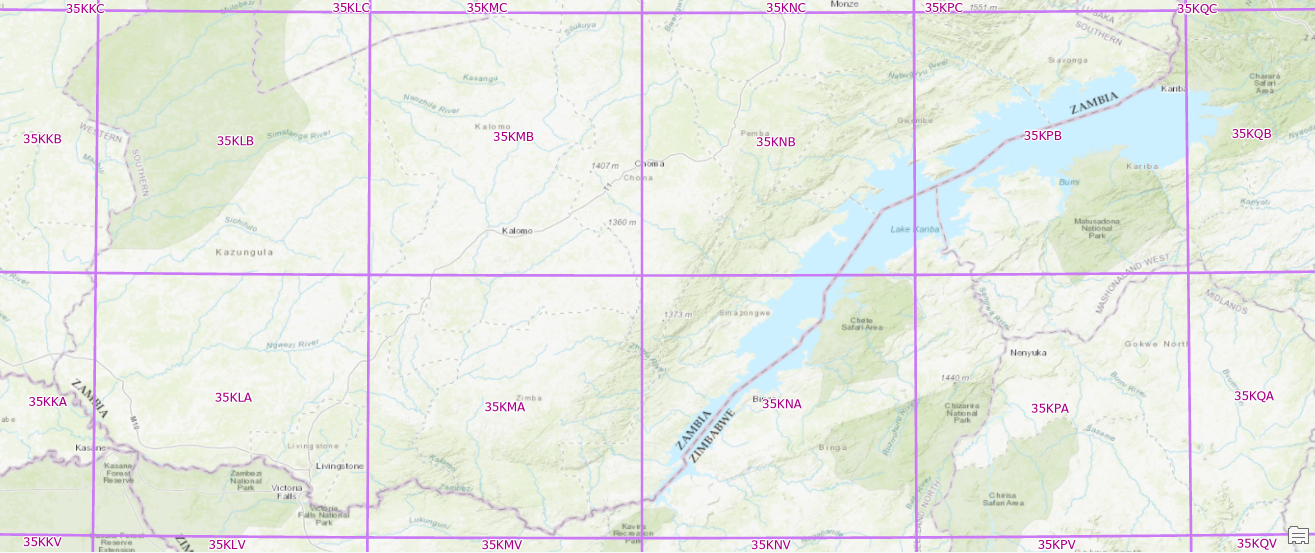
and Victoria Falls (35KLA, 35KMA and 35KNA) would be available to participants.
Sentinel 1 radar scenes would be also available for those who are seeking even more challenging challenge. These are not affected by clouds, however require much higher theoretical background and practical skills.