
Mentor: Hana Kubíčková
“Precision agriculture is a management strategy that gathers, processes and analyzes temporal, spatial and individual data and combines it with other information to support management decisions according to estimated variability for improved resource use efficiency, productivity, quality, profitability and sustainability of agricultural production” (An International Journal on Advances in Precision Agriculture, 2019) In other words, precision agriculture is an approach to farm management that ensure crops and soil receive exactly what they need for optimal health and productivity. In order to take the necessary action at the right time, to the right extent and on the right place, it is necessary to obtain the maximum amount of information relating to the field as possible. This includes not only the composition of the soil, the thickness of the topsoil and the supply of nutrients, but also the precise spatial delimitation of the field and information of the types of crops grown on particular field.
In the Czech Republic and many other European countries, this spatial and land use information is stored and regularly updated in the land register called Land Parcel Identification System (LPIS). However, if we want to use this information as input for precision agriculture use, we will encounter a major problem. This occurs when several type of crops are grown on the same field and we do not know the boundaries of individual crop types – the quotient of individual crops only – see Fig. 1.
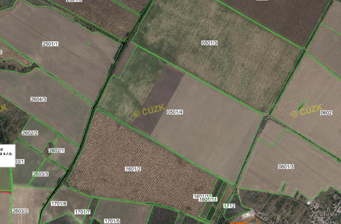
Fig. 1 Example of parcel with different land uses
Accurate information on field boundaries is very important input for many reasons: eg. having accurate information on crop types and boundary defining a given soil block, we can for example determine the yield potential or the amount of fertilizer needed for given type of crop very precisely.
The reason why these boundaries information are missing in LPIS lies mainly in the time consuming manual updating of the database. Therefore, automated methods are now being sought to detect precise field boundaries if they are not available in digital form.
One possible way is to exploit the potential of satellite imagery, which provide a wealth of information about Earth’s surface and are available as open data.
The aim of this challenge is to find possible machine learning algorithms and artificial neural networks that can be used for field boundaries detection from Sentinel 2 or Landsat images.
Available tools:
Web-based JupyterHub environment exposing a set of powerful Python-based tools. Anaconda platform provides plenty of NN, DL, ML. It is start point of every Data Science who likes Python”
Thanks to Anaconda Cloud following can be installed easily:
- Scikit-learn
- Keras
- Tensorflow
- OpenCV
- Vowpal Wabbit
- And many, many more
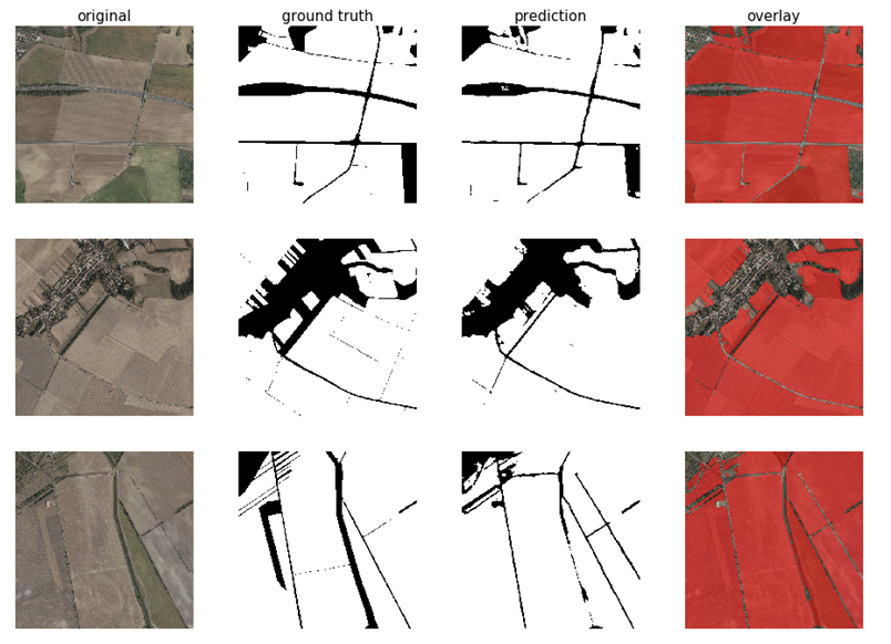
Fig. 2 Results of previous attempts on field boundaries detection using convolutional neural network UNet.