TEAM LEADER: Karel Jedlička
TEAM MEMBERS: Marcela Doubková, Dmitrij Kožuch
PROJECT IDEA: The idea is to expand Open Land Use map by computing main terrain characteristics of agricultural fields (LPIS blocks). So far for computation two datasets will be used 1arcsecond DEM dataset by USGS and Open Land Use map (for masking fields). The experimental area will be Weinviertel (province located in the norteast of Lower Austra).
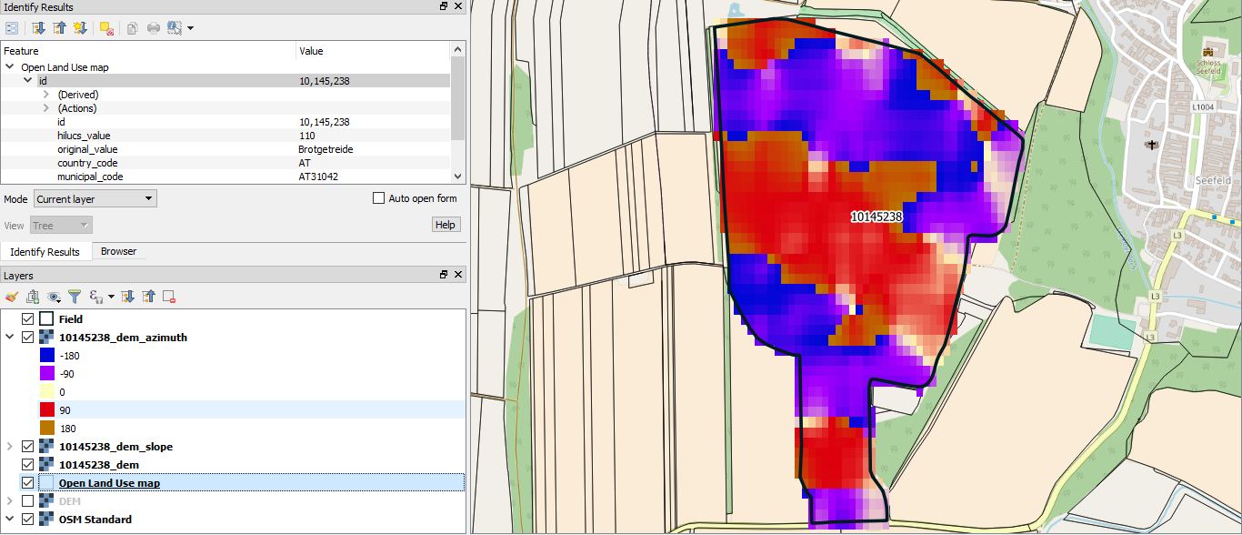
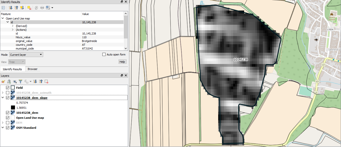
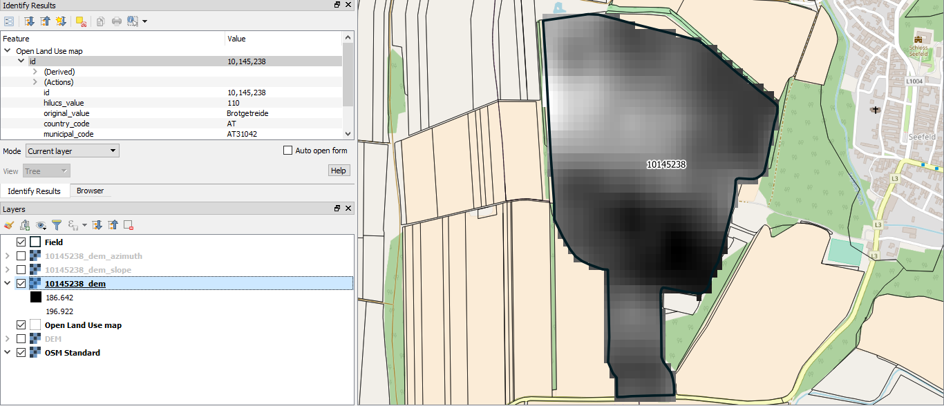
So far it is possible to get the main terrain characteristics of the field by entering its unique id in Open Land Use dataset. For example here are those characteristics for the field with id 10145238 .
{‘min_elevation’: 186.64203, ‘max_elevation’: 196.92177, ‘mean_elevation’: 190.70232, ‘median_elevation’: 190.44339, ‘min_slope’: 0.7573741, ‘max_slope’: 1.5695069, ‘mean_slope’: 1.2346609, ‘median_slope’: 1.2555954, ‘min_azimuth’: -179.98296, ‘max_azimuth’: 179.62314, ‘mean_azimuth’: -13.073845, ‘median_azimuth’: -30.859669}
Otherwise as well as get the statistics it is also possible to download characteristics as TIF images: