
A goal of this challenge is to design a prototype of an application, helping a farmer to make proper decisions leading to high yields whilst farming in a sustainable way. We believe that an evidence based decision making is the right way to do so.
The evidence comes from data, turned into information. The information then needs to be presented in a clear way, to help understanding of a studied system (knowledge) and objective reasoning (wisdom).
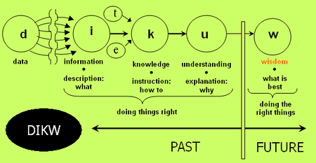 Fig 1. A flow diagram of the DIKW, source: https://en.wikipedia.org/wiki/DIKW_pyramid
Whereas the knowledge and reasoning/wisdom is here in the domain of agriculture, the data and information lies in the domain of geo-IT expert.
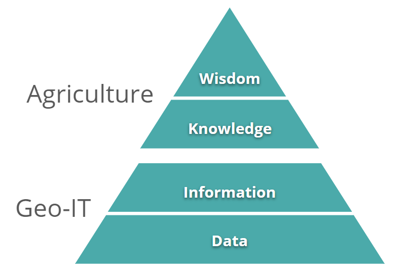
Fig 2. DIKW pyramid, created by authors
There is always a gap in between the Geo-IT and agriculture domain, which can cause misinterpretation of the provided information. We believe that a well designed application can help to minimize this risk. Therefore we would like to apply User eXperience (UX) based approach for the application design and prototype development. We understand that such an application can be quite complex, therefore we will start to work on two components of the application: agroclimatic factors calculated from climatic data and yield monitor based on the remote sensing data. We will take existing standalone applications (AgroClimatic Atlas prototype and yield monitor) as an input and put effort into integrating and simplifying them for the sake of the end-user.
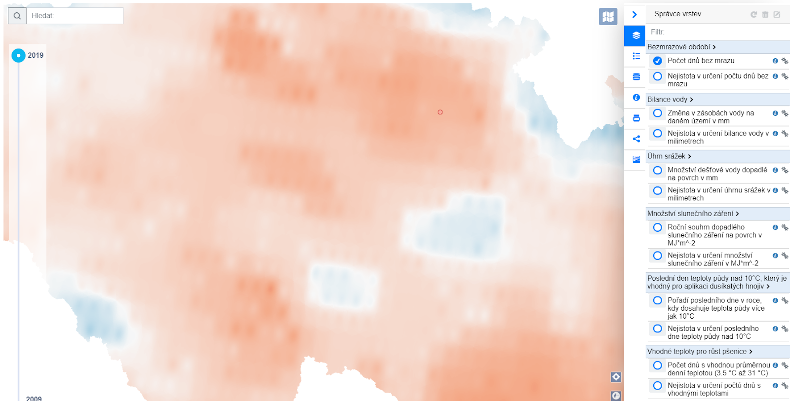 Fig 3. Prototype of AgroClimatic Atlas, source https://www.agrihub.cz/hsl-ng/AgroClima
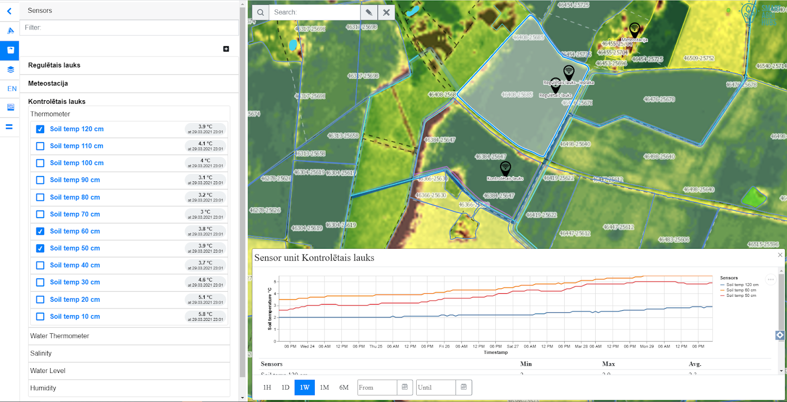 Fig 4. Prototype of yield monitor
The UX driven design of the integral application will be created by analysis of user needs, captured in a form of clearly described Use Cases. Each Use Case, describing an interaction of a user and the application, will be complemented with a mockup portraying the GUI involved in the Use Case, see example of a Mockup below.
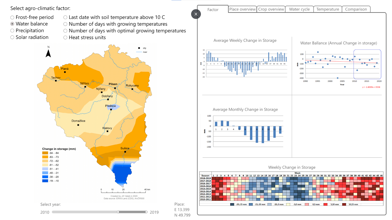 Fig 5. Mockup of Water Balance factor visualization, source: T. Andrš. Visualization of spatiotemporal phenomena – an example of agroclimatic factors, University of West Bohemia, bachelor thesis, ongoing.
The challenge will be driven by a group chat, complemented by virtual calls (skype), together with a task manager (redmine).
The challenge runs under the umbrella of Stargate, Sieusoil, Smartagrihubs and Demeter H2020 projects and InteCom project.
***The registration for this challenge opens on 1st April***
Registration link will be available at https://www.plan4all.eu/open-spring-inspire-hackathon-2021/
Your mentors are:
 Karel Jedlicka – Karel’s research’s background lies in modeling, analysis, and even simulation using multidimensional (geographic) data structures. In particular, Karel actively researches on 3D and 4D aspects of Geographical Information Systems. Primarily Karel focuses on the following application domains: analysis of trends in climatic and weather data for agricultural purposes, influence of transport to the city life by designing and developing interactive traffic models for Digital twins of Smart cities. Karel has been leveraging his skills in various (mostly EU funded) projects since 2007. Karel usually acts as a leader of a research or technical team in the project. He has participated in Stargate, EUXDAT, AfarCloud, and DataBio projects related to agriculture and S4allCities, TRAFFO, DUET, PoliVisu, and OpenTransportNet projects related to Smart Cities.Karel works as a researcher at the University of West Bohemia, Deparment of Geomatics and the living lab Wirelessinfo. He is a deputy chairman of Plan4all Association and a co-founder of a traffic modelling Startup RoadTwin.
 František Zadražil is a Project Coordinator of the HSLayers-NG framework. He has been working in the GIS field since he graduated in 2006 (Computer Graphics and Virtual Reality Engineering). After the years of SW development using various platforms (MapServer, GeoServer, ArcGIS) he became a GIS team leader and project manager and contributed to implementing numerous GEO systems for the public and private sector. He has expertise in GIS architecture and analysis.
 Pavel Hajek is a researcher and a lecturer at the Department of Geomatics. He participated in several EU projects such as OpenTransportNet, GEPAM, Peregrinus Silva Bohemica, or EUXDAT. His focus is mainly on data modeling, assembling, and gathering. His doctoral internship was taken at TU Delft (2014). Research activities: Geographic Information Systems (GIS), multidimensional data modeling – especially 3D data handling, cartography and visualization, 3D GIS/CAD/BIM.