
FINAL REPORT ON CHALLENGE #15: Drones utilisation for crop protection
Name of mentor(s): Zuzana Palkova, Patrik Kosa, Roman Danel
The challenge is managed by Zuzana Palkova (SUA) who is, together with Pavol Findura (SUA), responsible for coordination of the challenge, stakeholder engagement and communication with them. For research activities and presentations Roman Danel (database and data processing), Patrik Kosa (farming robots and drones) were involved.
FINAL-REPORT-Challenge 15 [PDF, 0,5MB]
INTRODUCTION
Background of the challenge
Good health and nutritional condition of crops, as well as optimal physical, chemical and biological properties of soil, are important features of the effects of certain environmentally friendly technologies and management efficiency in crop production. Currently, the health diagnosis and nutritional condition of crops are mostly made on the basis of the knowledge and experience of agronomists and long-term soil-climatic information about the particular production region. At the present time, the farmers are using their subjective ratings for diagnosis of nutrition and health condition of crops, respectively advice from specialists or distributors of fertilizers and plant protection products. This diagnostic is inaccurate in many cases and leads farmers to wrong decisions with a negative impact not only on production and thus economic efficiency of the business, but a negative impact can be seen also on the environment.
In the Autumn AgriHub INSPIRE HACKATHON 2021, the challenge opened the discussions and allowed us to clarify some of the requirements of target consumers, primary producers, and the effect of local climate conditions. In addition, several questions arose from the discussions, such as:
- Are the NDVI and EVI methods optimal or building a reference image database of different health conditions of plants will be necessary?
- Is there a real interest of farmers to use drones for the health and nutritional condition of crops diagnosis, considering the limitations of using drones?
- What will be the business model for further exploitation of developed applications?
The idea of the Spring Hackathon followed these findings and introduces two challenges – to present the possibilities for the exploitation and implementation of drones in agricultural practice, especially in the crop protection, and to open discussion for further cooperation for this field in the frame of the triple helix principle – R&D/farmers/SMEs.
Ambition of the challenge
To find the answer on these questions, we organized 2 meetings with the representatives of the SMEs and farmers and 1 large webinar dedicated to two topics: (i) Farming robots and the use of drones in agriculture and (ii) Competences of university students for the use of drones in agriculture, with an audience of registered 14 participants geographically covering countries throughout the whole Europe, then Africa, and also Asia.
The webinar recording is available on the Plan4All Youtube channel:
https://www.youtube.com/watch?v=TBVVdNIi6kc
Therefore, the aim of this challenge was to present examples of using drones utilization for crop protection:
- Detection of insufficient irrigation (color changes of crops not corresponding to the season and age of vegetation);
- Identification of plant diseases and pests (especially bacterial and fungal infections);
- Checking the condition of treetops (places that cannot be checked from the ground);
- Occurrence of strips of other (unsuitable) soil or rock species in the study area;
- Analysis of the permeability of the amelioration system;
- Inaccurate sowing detection;
- Identification of crop spraying by sprayer (too large a dose);
- Search for waterlogged places;
- Distribution of invasive plants or weeds;
- Documentation of crop losses for insurance claims.
Case study
Case Study: Project INVARO
- 2016-2019
- The aim: Detection of invasive plants (Soldigado gigantea, Heracleum) and analysis of their rate of spread
- Author’s method of risk assessment associated with the occurrence of invasive species
- Key output: Plan to reduce the risks associated with invasive plant species
- Verification: Orlová (CZ), Mszana (PL)
- http://invaro.vsb.cz/plants
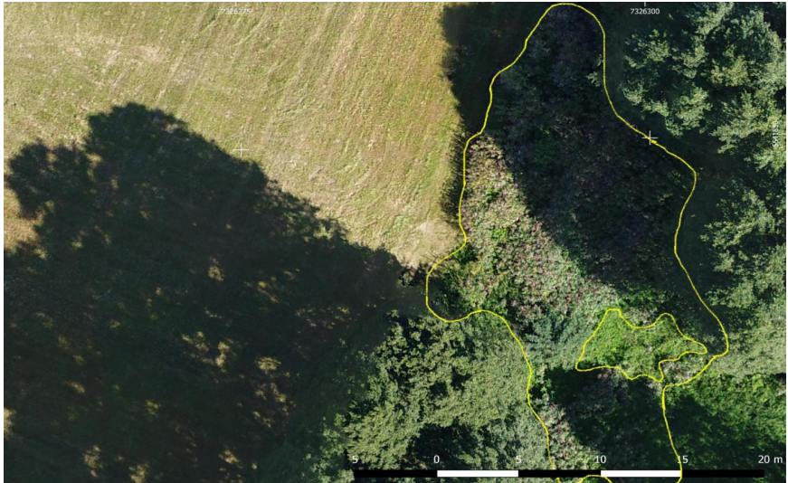
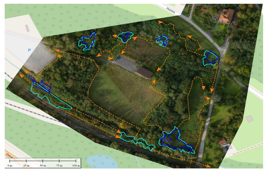
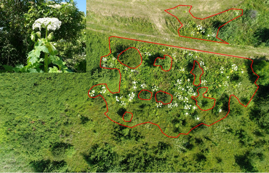
Analysis of spread according drone‘s images taken within 3 years
Technical Background
- Drone images (taken for 3 years)
- Vector data from ZABAGED
- Raster maps M10
- Orthophoto
- Elevation data from ZABAGED
- Cadastral data
FINDINGS & CONCLUSION
Discussion of the case study and findings of the challenge
The discussions and experiences from case studies discussed during both hackathons show that there is a request for specific knowledge of the students to be able to reflect the interest of the SMEs for commercial exploitation of the drones in agriculture. Specifically, we agreed on the following knowledge:
- Basic knowledge of GIS system
- Working with layers
- What map data sources are available
- How to combine different data sources
- Public data sources available for landscape analysis
- Public information systems for agriculture
- Methodology of drone/aerial images usage
- What drones are suitable for and when not
- Technical limitations