Plan4all at OGC Connect Cape Town: Connecting GeoAI, Open Standards and Local Innovation
Highlights from PoliRuralPlus, KijaniSpace and the Agriculture Domain Working Group, 12–15 October 2026
OGC Connect Cape Town 2026 | Photo collage from the event
Plan4all contributed to OGC Connect Cape Town, the Open Geospatial Consortium’s 136th Technical Meeting, held in South Africa on 12–15 October 2026. Under the event’s theme of advancing interoperable geospatial solutions for Africa, Plan4all helped connect practical examples from European research projects with discussions on agricultural data, artificial intelligence and open standards.
Karel Charvát (Plan4all) opened the Agriculture Domain Working Group (DWG) session “Agriculture in the Age of AI” on 13 October and presented the group’s closing plenary report on 15 October. Contributions from projects like KijaniSpace, PoliRuralPlus, and CEADS PSNC showed how local skills, semantic interoperability and conversational GeoAI can reinforce one another.
Agriculture in the Age of AI: Interoperability First
Karel Charvát framed AI in agriculture as a broad family of applications, including Earth observation, sensor analytics, forecasting, machine learning, computer vision and language-model interfaces. His presentation set out a layered view: reliable data and local knowledge; standards and shared semantics; analytical models; natural-language interaction; and, at the top, human decision-making.
The central principle was “AI proposes - people decide.” Human expertise remains necessary to validate outputs, consider uncertainty and make accountable decisions. Open standards such as OGC APIs and the Agriculture Information Model help ensure that data used by AI remains understandable and reusable.
KijaniSpace: Training and Innovation Around Lake Victoria
Jan Macura (Plan4all) presented how KijaniSpace combines Copernicus Earth observation, IoT and hands-on innovation for climate-smart agriculture. Its Space-IoT Talent Programme offers training and hackathons designed around local challenges in the Lake Victoria Basin.
The 2026 hackathons involved 41 participants in nine teams in Kisumu, Kenya, and 33 participants in seven teams in Mwanza, Tanzania. Across the programme, more than 100 people have been trained and more than ten minimum viable prototypes developed. Examples highlighted included MvuaSasa, NetiSmart and SamakiWatch.
The KijaniSpace Space-IoT Innovation Programme also envisages support for five start-ups and SMEs developing Earth observation and IoT solutions in the region.
PoliRuralPlus: Talking to Places with JackDaw
Stein Runar Bergheim (Avinet) presented JackDaw, the conversational GeoAI assistant developed in PoliRuralPlus. JackDaw enables people to explore geographic information through questions in natural language, connecting responses to authoritative spatial sources and services including Copernicus, Eurostat, INSPIRE, OGC APIs and STAC.
By lowering the barrier to complex geographic information, JackDaw offers a promising approach for rural development, territorial planning and data-driven decision support. Its emphasis on traceable source information is also central to responsible AI use.
Making OGC AIM Actionable with LLMs
Raul Palma (PCSSPSNC) introduced Gamma, an LLM-assisted approach to mapping heterogeneous datasets into RDF aligned with the OGC Agriculture Information Model. He also discussed Model Context Protocol tools for semantic discovery and access to AIM-compliant information.
These approaches provide a potential bridge between interoperable agricultural data and applications such as JackDaw. The discussions also highlighted opportunities to exchange experience with related European initiatives, including CEADS, and to explore future collaboration with PCSSPSNC.
Closing Plenary: Shared Priorities and Proposed Next Steps
In the closing Agriculture DWG report on 15 October, Karel Charvát linked the week’s contributions into a common storyline: KijaniSpace demonstrates local capacity building, AIM and LLM approaches strengthen the semantic foundation, and JackDaw offers accessible interaction with trustworthy geographic information.
The group highlighted priorities for the coming year: provenance and traceability of AI answers, expert validation, transparent uncertainty, local knowledge and data sovereignty, AIM-enriched metadata, and extension of practical GeoAI and Space-IoT training to other African regions.
Two potential outputs were proposed: a Discussion Paper on GeoAI in agriculture, with a focus on human oversight and provenance, and an interoperability experiment or pilot combining Gamma, MCP and JackDaw on AIM-compliant data. Both remain proposed follow-up activities.
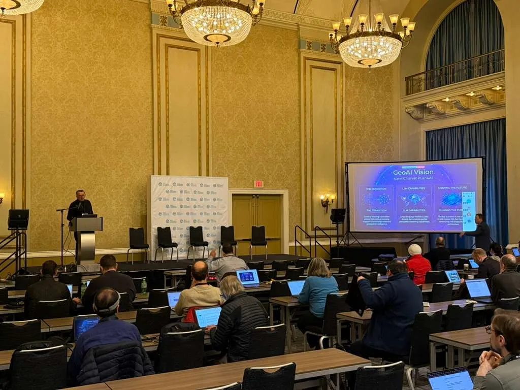
Agriculture and GeoAI discussions at OGC Connect Cape Town.
Connecting Research, Standards and Communities
The meeting underlined the importance of connecting technology development with local needs and international standards. Through KijaniSpace and PoliRuralPlus, Plan4all and its partners demonstrated complementary pathways towards human-centred, interoperable and practical digital innovation in agriculture and rural development.
Further information
OGC Connect Cape Town: https://www.ogc.org/event/ogc-connect-cape-town/
PoliRuralPlus: https://www.poliruralplus.eu/
KijaniSpace: https://www.kijanispace.eu/