EO data for monitoring agricultural activities at 122 OGC Member Meeting

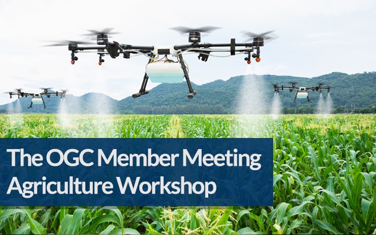
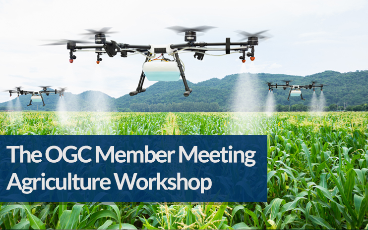
We would like to cordially invite you to join the upcoming Agriculture DWG session focused on theEO data for monitoring agricultural activities.

During the session we plan to provide insights to existing solutions, existing methods used for agriculture data analysis, but also current problems and visions for the future.

Our speakers will address following questions:

  • What kind of data do you use for monitoring agricultural activities? (satellite data, in-situ data, aerial data)
  • What data models do you use for EO data?
  • What architecture do you use for EO data?

The session will be held during the 122th OGC Member Meeting on Tuesday 1st March, 2:30 PM CET.

Agenda

  • Intro Ag DWG chair (Karel Charvát)
  • Use of Sentinel-1 and Sentinel-2 data in agricultural data analysis (Herman Snevajs, Plan4all)
  • NIVA support to the EO monitoring of CAP payments (Dominique Laurent, IGN)
  • EuroCrops and HCAT: Collecting and Harmonising open agricultural data within the European Union (Maja Schneider, TUM) 
  • E³ SAFER F³: Nature produces Ecology Economy Energy Sustainable Agriculture Forestry Environment Risk-management with Farm Fork Fun (Walter H. Mayer, PROGIS)
  • The role of standards in strengthening agricultural monitoring in Africa (Lilian Ndungu, RCMRD)
  • What are we doing wrong? Why have farmers not used EO services regularly so far? What can we change in the future? (Runar Stein Bergheim, Avinet)

Register for the workshop at https://na.eventscloud.com/website/34558/

IST-Africa 2022 – Call for Papers – Extended Deadline 31 December

Hosted by the Government of South Africa through the Department of Science and Innovation and Supported by the European Commission (EC) and African Union Commission (AUC), IST-Africa 2022 (May) is the seventeenth in an annual series of Ministerial Level Technology Research and Innovation Conferences. IST-Africa 2022 has Technical Co-Sponsorship by IEEE Society on Social Implications of Technology and IEEE Africa Council.  

The IST-Africa Conference Series provides a world-class strategic platform rotating around Africa to strengthen technology-enabled Innovation, Science and Technology and Entrepreneurship related policy dialogues within Africa and between Africa, Europe and the rest of the world, Global Development, Research and Innovation Cooperation and Community Building. It also provides an opportunity to identify potential partners for future research cooperation under Horizon Europe and other international funding programs. IST-Africa is a unique community that brings together cross-disciplinary stakeholders from public, private, education and research, societal, funding and international donor sectors with end user communities focused on ICT and STI Research and Innovation and Technology-enabled Entrepreneurship.

IST-Africa 2022 Call for Papers invites full papers (8 pages in length) using the paper guidelines and IST-Africa template provided at http://www.ist-africa.org/Conference2022/default.asp?page=paperguidelines  to be submitted online for blind peer review by the extended deadline of 31 December. 


Thematic areas addressing achieving the UN Sustainable Development Goals (SDGs) include: 

  • Technology-enabled Healthcare (mHealth /eHealth) 
  • Technology-enhanced Learning and eSkills 
  • Technology-enabled Agriculture (mAgriculture /eAgriculture) & Environmental Sustainability 
  • Energy – ICT for Power Delivery, Micro-grids 
  • eInfrastructures and NRENs (National Research and Education Networks) 
  • Next Generation Computing including Artificial Intelligence, Big Data, Cloud Computing, Future Internet, Internet of Things (IoT) 
  • eGovernment and Public Service Delivery 
  • Content Technologies including Languages; Digital Preservation 
  • Cyber Security, Privacy and Trust 
  • Collaborative Open Innovation and Technology-enabled Entrepreneurship (including Social Entrepreneurship) 
  • Global Development (including ICT4D) 
  • Societal Implications of Technology

Please download the Call for Papers for more information – http://www.ist-africa.org/conference2022/files/ISTAfrica2022_CallforPapers.pdf  and receive regular updates by following us on Twitter http://twitter.com/ISTAfricaNews    

Please note only full papers are assigned for review. 

Papers must present analysis of policy, initial or final research results or a case study. It is important to highlight actual or expected impact as well as the level of innovation. General project descriptions or descriptions of proposed research will not be reviewed. 

It is necessary for the paper submitted to include a unique element that has not previously been published and any previous published materials to be clearly referenced (including material previously published by the authors). 

Each presenter can present ONE paper in the Programme. It is necessary for papers to be presented by an author / co-author and answer questions based on the presentation during the event to ensure inclusion in the Proceedings. 

Please only submit papers for review where there are authors/co-authors who will complete registration. Please do not submit multiple papers for which there is only one author who can register. Click here for more details. 

The Agrihub INSPIRE Hackathon 2021 has its winners!

The Agrihub INSPIRE hackathon  focused on developments and innovations in agriculture, the environment, geospatial applications, remote sensing and GNSS is after two-month hacking over! More than 30 participants have contributed to all 8 challenges to support digital innovation hubs in Czechia and Slovakia. Results were evaluated by an international experts jury. The jury members Emilija Oreščanin (BioSense Institute), Bente Lilja Bye (BLB, Plan4all), Josef Hnojil (Geobusiness) and Jiri Panek (GISportal) announced the following winners for the Agrihub INSPIRE hackathon:

  • 1st place: Agro Environmental Services (presentation is available here)
  • 2nd place: Analysis, processing and standardisation of data from agriculture machinery for easier utilization by farmers
  • 3rd place: Business cases for WhiteBoard

In addition to jury, we also gave the public the opportunity to choose top 3 teams. The public vote turned out as follows:

  • 1st place: Business cases for WhiteBoard
  • 2nd place: Agro Environmental Services / Crop Detection
  • 3rd place: Extreme Weather

Congratulations to all the winning teams and many thanks for excellent work to all participants! See you in next INSPIRE Hackathon!

The Agrihub CZ&SK project  is financed by the SmartAgriHubs Project.

Agrihub INSPIRE Hackathon Final Event: Awards & Ceremony

The Agrihub INSPIRE Hackathon 2021 focused on developments and innovations in agriculture, geospatial applications, remote sensing and GNSS goes after two-month hacking into the final stage scheduled on Wednesday 15th December 1:00 PM CET! More than 30 participants have contributed to all 8 relevant series of challenges  to support digital innovation hubs in Czechia and Slovakia and their results are evaluated by an international experts jury.

During the final event, you will find out which top 3 teams were chosen by the jury and you will get acquainted with results of each challenge.

GET AN OVERVIEW OF THE HACKATHON RESULTS:

  • Results from 8 different challenges
  • Rewards ceremony and celebration


Are you interested in results of the Agrihub INSPIRE Hackathon? Do not hesitate to register for this final presentation of results & awards ceremony!

Register now!

The Agrihub CZ&SK project  is financed by the SmartAgriHubs Project.

Semantic Interoperability as an Instrument to build Digital Twins supporting SDGs at 121th OGC Member Meeting

9 December, 7:00 – 8:30 PM CET  

We would like to cordially invite you to join the upcoming Agriculture DWG session on identifying theSemantic Interoperability as an instrument to build Digital Twins supporting SDGs.

During the session we plan to provide insights into semantic data models related to different scales of agriculture related data,  semantic models for IoT and EO monitoring, semantic model for metadata and how this models can be interlinked and connected with analytical tools like AI, data mining, etc.

The session will be held during the 121th OGC Member Meeting on Thursday 9 December, 7:00 – 8:30 PM CET.

Our speakers will address following questions:

  • Why is semantics important for Agriculture?
  • Where do you use semantics in Agriculture?
  • Which semantic models for agriculture are you generally familiar with?
  • How to link different semantic models with analysis and modeling (data mining, AI, etc).

Agenda

  • Intro Ag DWG chair (Karel Charvát)
  • Publication of linked data from soil-related data sources (Raul Palma, PSNC)
  • AI & ML models for Agricultural Monitoring based on EO data (Benson Kipkemboi Kenduiywo, RCMRD)
  • Development and implementation of a Spatio-temporal Agricultural Landscape Information Model (Marija Knezevic, Technical University of Munich)
  • Semantics for Agricultural Climate Data (Heiner Denzer, METOS)
  • Panel discussion
  • Wrap-up and what’s next?

Register for the workshop at https://na.eventscloud.com/ereg/newreg.php?eventid=640986&language=eng

Plan4all as a Participating Organisation in the GEO Programme Board

We are delighted to let you know that the Plan4all association, one of  the 138 Participating Organizations of the Group on Earth Observation (GEO), has received a seat in the GEO Programme Board

The GEO Programme Board supports the ongoing development and implementation  of the GEO Strategic Plan 2016 – 2025: Implementing GEOSS through multi-year GEO Work  Programmes. 

Specifically, the GEO Programme Board: 

  • Works to ensure the overall coherence and alignment of the GEO Work Programmes with  GEO’s Strategic Objectives and Core Functions; 
  • Works to align the scope and substance of tasks, GEO Initiatives and Flagships in the  GEO Work Programme with the resources committed by Members and Participating  Organizations; 
  • Supports and enables cross-cutting coordination and knowledge exchange, especially best  practices; and 
  • Promotes GEO Work Programmes and engagement of stakeholders in their  implementation. 

Becoming a Participating Organisation of the GEO Programme Board is considered as a significant achievement and appreciation of our work and the work of our members.

AgriHub INSPIRE Hackathon 2021 has included discussion about building the team for new Horizon Europe calls

As part of the sustainability of the innovation experiments taking place within the AgriHub CZ&SK project, we decided to include a discussion on building new teams for Horizon Europe Calls as part of the activities of each AgriHub INSPIRE Hackathon challenge. Working in teams gives an excellent opportunity to identify potential partners and technologies for future challenges. This can lead to the establishment of long-term collaborations between some partners. A common work can bring together people from different technical, business and user communities and open up new opportunities for future work, which can help you to identify who may be useful for future collaborations. We have already identified some potential calls that could be relevant for hackathon challenges.

A common interest for Challenge #1 Crop Detection, Challenge #2 Crop Status Monitoring  and Challenge #8 – Business cases for WhiteBoard has been identified in the following calls:

During our next discussion we plan to select one priority. Join us in our hackathon activities. Register yourself to challenges at https://docs.google.com/forms/d/e/1FAIpQLSeBsv2awD05L6q_4zxST9hR81ar8WxSnR7zfdf9VRfQLzITnQ/viewform

AgriHub INSPIRE Hackathon 2021 Kick-off Webinar

Are you thinking about joining a hackathon and don’t know how to do it? Or are you still unclear about the objectives of the challenges? Then don’t hesitate to take advantage of this unique opportunity to learn more about the hackathon within one hour.

During this special webinar, we will give you an overview of the main mission of the AgriHub INSPIRE hackathon. Our mentors will tell you more about goals of individual challenges that have been defined for the hackathon and last but not least, we will provide you with the information on how you can get involved in the hackathon as a participant.

In case of your interest, do not hesitate to register for this webinar HERE!

***The registration for the challenges is still open! Check the table below, choose the challenge and register for the hackathon HERE***

TEAMPROJECT TITLE & DESCRIPTIONMENTOR
TEAM 1Crop Detection
Crop detection will be based on analysis of time series from Sentinel-1 and Sentinel-2 and other data using AI methods. These outputs will be offered to advisory services, financial and public sector.
Herman Snevajs, Iva Bartlova
TEAM 2Crop Status Monitoring
Crop status monitoring methods based on analysis of time series of Sentinel-1 and Sentinel-2 and other data (crop rotation, IoT, yield monitors, etc.)
Herman Snevajs, Vincent Onckelet
TEAM 3Agro Environmental Services
Agro-environmental services will provide uptake of Copernicus and INSPIRE to support agri-food and environmental opportunities.
Martin Tuchyňa
TEAM 4Irrigation Management
Irrigation management will provide recommendation for integration of existing climatic, IoT and Copernicus data.
Jakub Fuska
TEAM 5Extreme Weather
Extreme weather will provide recommendations for the integration of climate data, IoT and Copernicus data.
Tereza Šamanová
TEAM 6Drones utilisation for crop protection
Utilisation of drones for crop monitoring and application of pesticides/herbicides
Miroslav Konečný, Zuzana Palková
TEAM 7Analysis, processing and standardisation of data from agriculture machinery for easier utilization by farmers
Machinery monitoring challenge will provide the analysis, processing and standardization of data from the agricultural machinery and thus its easier utilization by farmers.
Pavel Gnip, Jaroslav Šmejkal
TEAM 8Business cases for WhiteBoard
Identifying new business cases for utilization of MapWhiteBoard as a part of different applications or as a part of different solutions.
Karel Charvát, Runar Stein Bergheim

Agrihub INSPIRE Hackathon: Challenge #8 – Business cases for WhiteBoard

The vision of the Map Whiteboard innovation was born out of a sequence of large-scale collaborative writing efforts using Google Docs. As opposed to traditional offline word processing tools, Google Docs allows multiple people to edit the same document—at the same time—allowing all connected clients to see changes made to the document in real-time by synchronising all changes between all connected clients via the server. The ability to work on a shared body of text, avoiding the necessity to integrate fragments from multiple source documents and with multiple styles removed many obstacles associated with traditional document editing. The Map Whiteboard technology seeks to do the same for the traditional use of GIS tools.

The Map Whiteboard is not limited to editing a shared dataset. The technology shares the entire map, presenting the data in the context of any background information that may be useful. It allows multiple clients to see the identical map interface and simultaneously draw on it, emulating the widespread use case of sitting around a meeting table looking at a map together, annotating it, pointing at “things”, and proposing changes. To realize the vision of the Map Whiteboard technology, it is necessary to make certain behaviour of GIS applications interoperable across instances and platforms. The interoperability is limited to the smallest common denominator between different platforms in terms of the types of business objects that are present in each application, what functions they expose and which events they emit.

The MapWhiteboard (Link) was developed over the span of multiple INSPIRE Hackathons and during last INSPIRE Hackathon https://www.plan4all.eu/2021/06/the-open-spring-inspire-hackathon-2021-final-awards-ceremony-event/ the solution was awarded as the best challenge https://www.plan4all.eu/2021/03/challenge-7-interactive-collaborative-data-capturing-at-scale-technology-and-business-models/.   The current status was also published in research journal https://ojs.wiserpub.com/index.php/CCDS/article/view/897 

Challenge goals:

The goal of the challenge is to (a) develop new business cases where MapWhiteBoard technology may provide added value through  new applications or integrated into existing solutions and (b) further elaborate previously identified business cases. These are: (1) using the map whiteboard to improve the communication between agricultural advisors and farmers and (2) using map whiteboard technology to do collaborative data capturing for to inform decision making in land-use planning.

To identify and elaborate business cases, this challenge will stage discussions with representatives of envisioned end-users as well as developers and investors to look at different opportunities, and how to exploit them to build a viable business. The work in challenge will include the following activities:

  • Practical demonstration and testing of solution
  • Brainstorming about potential application for MapWhiteBoard
  • Trial integration with existing applications
  • Conceptual design for new applications
  • Development of lean business model canvas