The Environmental Atlas of the Liberec Region in QGIS is Almost Ready

Are you interested in this hackathon project?  Have you visited this atlas?

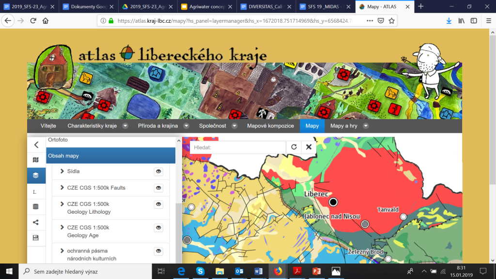
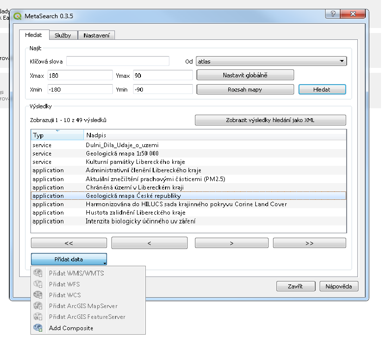
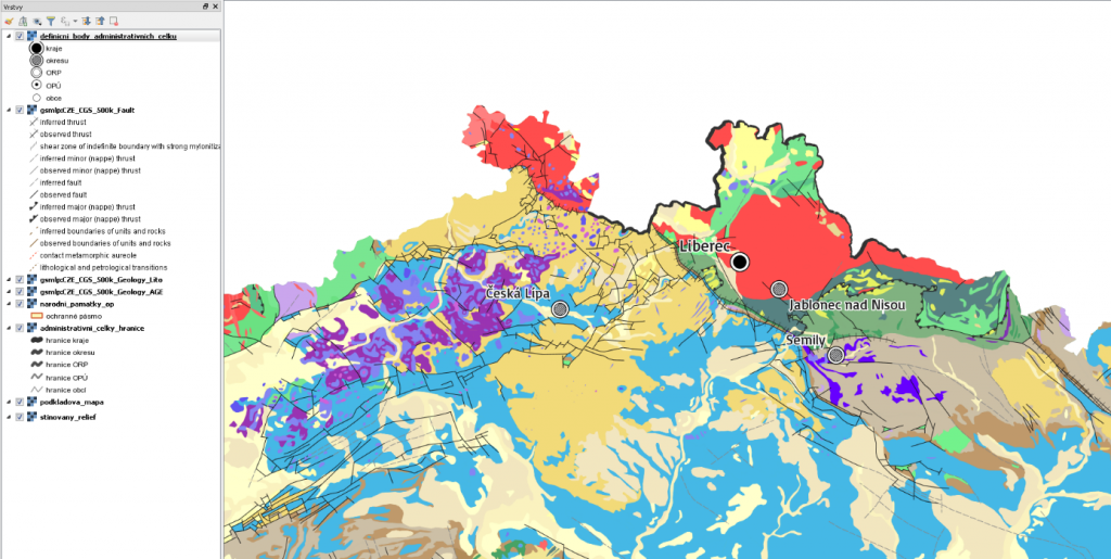
I am happy that team has done a large progress and QGIS is now ready to discover and visualize map compositions from the Liberec Atlas.

See our solutions


This is other step to the vision of social space for geospatial data, which members of Plan4all  started developed in past in the SDI4APPS and OTN projects. Join us and help us build this vision and make geospatial data available for everybody.

Would you like to know more about this concept and solution join our webinars where this concept will be presented.


Progress report for QGIS as a Client for DataBio/FOODIE RDF Data

We started to analyse, how to query farmers satellite data from farm management information systems. Help us with this tasks and agree on a common interface.

Farm data or field data (it could be a single field)

Processed data on the hub (data could be stored as processed or process can be calculated on demand).

What a farmer needs

Response could be or raster or vector.

Tasks

  • How could be queried server from client side (if we are using defined processing, probably we can use the same query for both stored or processed data)
    • we need define, how will look API for querying
    • we need define data model for transferring data for single fields
  • How will be send back result
    • in case of vectorized data, probably will be necessary to define only format and model
    • in case of raster data?

QGIS as a Client for DataBio/FOODIE RDF Data

We started to develop the project for the Prague Hackathon related to use of the desktop solution QGIS as a client for DataBio/FOODIE RDF Data. The work is divided into next steps:

  • Find farm/field boundaries on the client side (QGIS)
  • Display selected data from the farm/field
  • Query the server with satellite data for data from the farm/field
  • Display the selected satellite data for the farm/field in QGIS

That there is no common interface/API for sharing relevant field boundaries data between platforms. It’s therefore difficult to query different satellite hubs and request processed data from these hubs and then also receive back raster of vector data for concrete fields or farms. We would like to use this hackathon as a start for such discussion among different players to agree a set of standards that would enable interoperability between different hubs. We would like to ask all for comments and ideas. Please contact us at charvat(at)lesprojekt.cz and join our effort.