Agrihub INSPIRE Hackathon: Challenge #8 – Business cases for WhiteBoard

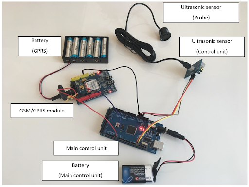
The vision of the Map Whiteboard innovation was born out of a sequence of large-scale collaborative writing efforts using Google Docs. As opposed to traditional offline word processing tools, Google Docs allows multiple people to edit the same document—at the same time—allowing all connected clients to see changes made to the document in real-time by synchronising all changes between all connected clients via the server. The ability to work on a shared body of text, avoiding the necessity to integrate fragments from multiple source documents and with multiple styles removed many obstacles associated with traditional document editing. The Map Whiteboard technology seeks to do the same for the traditional use of GIS tools.

The Map Whiteboard is not limited to editing a shared dataset. The technology shares the entire map, presenting the data in the context of any background information that may be useful. It allows multiple clients to see the identical map interface and simultaneously draw on it, emulating the widespread use case of sitting around a meeting table looking at a map together, annotating it, pointing at “things”, and proposing changes. To realize the vision of the Map Whiteboard technology, it is necessary to make certain behaviour of GIS applications interoperable across instances and platforms. The interoperability is limited to the smallest common denominator between different platforms in terms of the types of business objects that are present in each application, what functions they expose and which events they emit.

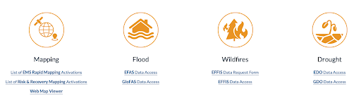
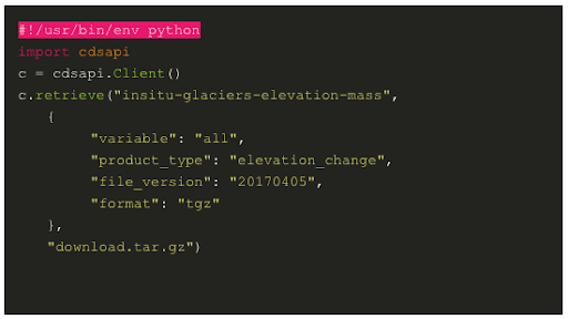
The MapWhiteboard (Link) was developed over the span of multiple INSPIRE Hackathons and during last INSPIRE Hackathon https://www.plan4all.eu/2021/06/the-open-spring-inspire-hackathon-2021-final-awards-ceremony-event/ the solution was awarded as the best challenge https://www.plan4all.eu/2021/03/challenge-7-interactive-collaborative-data-capturing-at-scale-technology-and-business-models/.   The current status was also published in research journal https://ojs.wiserpub.com/index.php/CCDS/article/view/897 

Challenge goals:

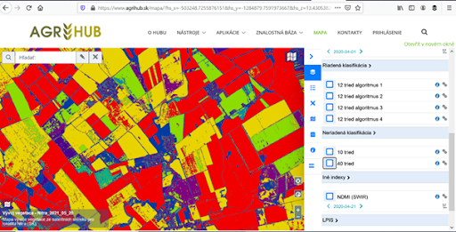
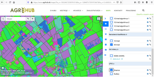
The goal of the challenge is to (a) develop new business cases where MapWhiteBoard technology may provide added value through  new applications or integrated into existing solutions and (b) further elaborate previously identified business cases. These are: (1) using the map whiteboard to improve the communication between agricultural advisors and farmers and (2) using map whiteboard technology to do collaborative data capturing for to inform decision making in land-use planning.

To identify and elaborate business cases, this challenge will stage discussions with representatives of envisioned end-users as well as developers and investors to look at different opportunities, and how to exploit them to build a viable business. The work in challenge will include the following activities:

  • Practical demonstration and testing of solution
  • Brainstorming about potential application for MapWhiteBoard
  • Trial integration with existing applications
  • Conceptual design for new applications
  • Development of lean business model canvas

Agrihub INSPIRE Hackathon: Challenge #7 Analysis, processing and standardisation of data from agriculture machinery for easier utilization by farmers

Operation of agricultural machinery significantly influences the economic profitability of crop management. First of all, the fuel consumption, machines and operators workload, control of performed treatments and the environmental effects such as reducing the risk of deterioration of soil physical properties. From a technical point of view the monitoring system involves tracking of the vehicles position using GPS combined with acquisition of information from on-board terminal (CAN-BUS, ISOBUS – ISO XML) and their online or offline transfer to GIS environment.

Verification of the monitoring system will be done at medium-sized farm, where it will serve for an evaluation of tractors work during basic operation such as soil tillage, fertilization, sowing and application of pesticides. Similar monitoring will be tested at the enterprise which is offering services for farmers for assessing the quality of work for customers.

  • Evaluation of the economic efficiency of machinery operations within the fields
  • Precise records of crop management treatments
  • Management of machinery operations – increasing the efficiency of planning of crop management
  •  Control of requirement for field operations:
    • control of pass-to-pass errors and overlaps, coverage of maintained area and recommended work speed
    • Control of applied input material in comparison to prescribed rates
    • On line monitoring of weeds
    • On line monitoring of weather on machinery

CHALLENGE GOALS:

Tracking the machinery fleet which allows localization of farm vehicles in real time. This information provides an overview of current operations of machines and is crucial for the planning of field work and an evaluation of machines usage in time. Monitoring of machine location using GPS and GSM/GPRS allows calculating working time, downtime and base information from CAN-BUS, ISOBUS (ISOXML). The base alarm function could be implemented into the system to alert when the machine is leaving the defined area or in case of rapid decrease of the fuel level.


Figure 1: Farm telemetry

Evaluation of economic efficiency of the crop management treatments within the fields. A prerequisite is the identification of fields and tractor equipment for the accurate estimation of field job costs based on the fuel consumption and used and working time. An analysis of tractor passes with information about machine parameters allows evaluating compliance of working widths and operation speed, which are an indicator of the quality of field work. Simultaneously records of performed operations will be used in agronomic registration.

Evaluation of machinery passes on the soil environment. This includes detailed analysis of the tractor trajectories within the fields considering the site specific conditions. The aim is to estimate the negative effect of machine tracks on the soil environment (especially soil compaction) and compliance of agro-environmental limits (nitrates directive, GAEC, protection of water resources, etc.). An optional extension of this evaluation represents a connection of machinery tracking with the records of applied materials (fertilizers, pesticides) from the board computer to check the accuracy of the application of agrochemicals.

The registration for the challenges is open! Are you interested in this challenge? Register for this hackathon challenge HERE.

Agrihub INSPIRE Hackathon: Challenge #6 Drones utilisation for crop protection

Good health and nutritional condition of crops as well as optimal physical, chemical and biological properties of soil are important features of the effects of certain environmentally friendly technologies and management efficiency in a crop production. Currently, the health’s diagnosis and nutritional condition of crops are mostly made on the basis of knowledge and experience of agronomists and long-term soil-climatic information about the particular production region. However, there is an absence of unified procedures and methodologies for reliable decision-making. Now, the high current research topic and in full compliance with the AgriHub CZ&SK scope is given at the time of development of information technologies and intelligent systems to support decision making. Focal orientation of the activity is aimed to evaluation of health status of the economically important agricultural crops and to evaluation of occurence of pests and diseases concentrations in the target crop and soil.

At the present time, the farmers are using their subjective ratings for diagnosis of nutrition and health condition of crops, respectively advice from specialists or distributors of fertilizers and plant protection products. This diagnosis is inaccurate in many cases and leads farmers to wrong decisions with a negative impact to production and thus economic efficiency of the business. The current trends tell us that just two-dimensional optical systems and computer vision represent the direction that is heading toward the development of new innovative methods for identification and location of the specific objects. Wide range of possibilities of application of these technologies helps to its development and finds new ways of its use and implementation in agricultural machinery.

On the one hand, visual detection and object recognition by using multispectral images is a very complex problem, but the farmer can respond to the current situation more variable where the situation is often and rapidly changing in the agricultural sector.

On the other hand, it is possible to simultaneously monitor several areas because data processing can be made significantly more complex. The mapped areas can be analysed, identified and realisabled with 2D respectively with a 3D image processing system much more precisely as current existing sensor systems and methods. The factors of cost and productivity are added in the specific types of applications, for example mapping of agricultural areas or localizing specific objects which are globally positive (useful) for standardization of the entire detection and control system for decision support.

CHALLENGE GOAL: The main aim of the activity is to develop sensing methodology, a hardware and software solution being able to determine the coordinates of each region together with its geometrical dimensions in order to provide accurate information in the form of maps of areas with weeds, pests and diseases, or areas with low nutrient concentrations, using commercially available unmanned vehicles that will include specialized sensing devices. 

The proposed methodology for identifying problematic areas of a selected crop will result from the measured data, whether in an imagery form through specialized cameras, or from sensors. Consequently problematic areas in the crop will be identified and then the anticipated nature, extent and cause of damage will be determined. The system determines the coordinates, suggests procedures, methods and dosage and unmanned devices apply designated substances.

The autonomous and independent sampling of plants for the thorough identification of weeds, diseases, or pests in a selected crop, and the collection of soil samples to determine the physico-chemical properties will be implemented in two forms:

  •     Higher crops – using commercially available unmanned vehicles complemented with a unique robotic device designed for the actual sampling, storage, and transfer of biological material;
  •     Lower crops – a mobile autonomous device will include a robot for the collection, storage, and transport of samples of soil and biological material.

The (information) system to support decision-making in the field of the automated assessment of measured and collected data for the purpose of the precise application of chemicals to eliminate weeds, pests, and diseases in a crop or adding nutrients to the soil. The system for the decision support will include a mobile application which will provide the information on the precise localization for the application of chemicals based on created maps and GPS signals.

The registration for the challenges is open! Are you interested in this challenge? Register for this hackathon challenge HERE.

Agrihub INSPIRE Hackathon: Challenge #5 Extreme weather

Recent advancement in predictive skill and spatio-temporal resolution of short-term forecasts as well as availability of seasonal weather forecasts can provide additional assets in crop management optimization and significantly contribute to reducing the negative impact of extreme weather.

The main focus of this activity is to build dedicated downstream services based on Copernicus EMS (CEMS), Atmosphere (CAMS) and Climate Change (C3S). CEMS provides already free access to flood, forest fire and drought early warning and monitoring. Copernicus Atmosphere and Climate Change service holds freely available estimates of important climate indices for past, present and future climate conditions which could be exploited also in the domain of agriculture. Accessing this data and building agriculture-oriented services is likely not feasible for small user groups or single users. Therefore, SmartAgriHub could provide a single-entry port and co-design eco-system for shaping, implementation and integration of such a service.

Challenge will include: 

  • Exploitation of the possible use of Copernicus Emergency Management services including European Flood Awareness System and European Drought Observatory 
  • Integration of the information from volunteer observatories of extreme events repositories to provide additional source of information to be assimilated with traditional observations available or to complement missing observations (e.g., hail) to be used for e.g., insurance claims. 
  • Integration of VGIs and citizen science data to validate/assimilate/train remove observations (e.g., crop diseases, grow monitoring)


Picture 1: CEMS Data Access


Picture 2: CAMS Data Catalogue


Picture 3: CAMS Daily Analyses and Forecasts


Picture 4: C3S Data Store Toolbox


Picture 5: C3S Data Store API

Whom do we search for? What skills should the participant have?

  • SMEs and/or research teams coming from academia, RTOs as well as larger companies able to build API, data models, and, as a result, solutions that could be used as an early-warning system related to extreme weather for small user groups or individual farmers.
  • The participants should be familiar or be able to work with Copernicus EMS (CEMS), Atmosphere (CAMS) and Climate Change (C3S) and build their solutions on these predictive systems
  • The proposed solutions should be applicable in the conditions of small groups of farmers or individual farmers – which means simple, user friendly and intended for a non-tech community.

The registration for the challenges is open! Are you interested in this challenge? Register for this hackathon challenge HERE.


Agrihub INSPIRE Hackathon: Challenge #4 Irrigation management

The challenge is focused on the calculation of the water reservoir storage capacity based on the DEM of reservoir bottom and current water level with the incorporating the water reservoir watershed parameters and precipitation forecast. The input data should be stored and processed in WebGIS server platforms (GeoServer, PostGIS).

As the farmers are pumping out the water from reservoir, the water storage is decreasing and the water level is descending. The water level elevation can be surveyed with existing prototype of ultrasonic sensor that stores the currently measured and calculated water level elevation in database and with the use of reservoir DEM we can calculate the current amount of water in reservoir.

As the longer periods of droughts are presumed worldwide (climate change in progress), the amount of available irrigation water is crucial. If we would be able to incorporate the data from watershed (watershed terrain slopes, land use, soil types, etc.) and the prediction of precipitation (weather forecast), we can predict the amount of water that will flow to reservoir during drought period and during/after rain event. This would help the farmer to manage the usage of remaining water amount in reservoir by altering the uptake of water for irrigation.

Provided data:

  • Reservoir bottom DEM and Reservoir watershed DEM, Soil map – georeferenced GeoTIFF data
  • Current water level – current value stored in the database – this will be only simulation of real operation as the water level sensor will not be deployed in real conditions

Data to provide by participants:

INSPIRE data suitable for rain forecast (optionally other meteorological data reqired for possible more precise hydrological models), Land use (e.g. CORINE dataset, Satellite imagery and its products) and so on.

We are looking for participants that are familiar with GIS modelling and hydrology (surface runoff modelling) and Web/WebGIS coding (GeoServer, PostGIS, web map libraries such as Leaflet, OpenLayers).

The registration for the challenges is open! Are you interested in proposing the water irrigation decision support tool that will be later available at Czech and Slovak Agrihub? Register for this hackathon challenge HERE.

Figure 1: Elevation data of reservoir bottom and reservoir watersheshed

Figure 2: WebGIS map of water reservoir – usable on computer or in the field with cellphone

Figure 3: Sensor and communication unit to provide the current water level elevation survey

Agrihub INSPIRE Hackathon: Challenge #3 Agro Environmental Services

This challenge will identify all data and information resources relevant for the agri-food sector and provide an unified access, including utilisation of Copernicus and INSPIRE initiatives, taking into the consideration progres in Open Data and eGoverment. Special focus will be on establishment of the synergies with Destination Earth activities. In addition, it will support identification of use cases, where such data and services might help to improve the current situation, or deliver new innovations. For selected use-cases, pilot implementations will be supported in order to address main involved stakeholders and deliver outcomes with potential for further re-use and development. Examples of initial use-cases proposals:

  • Mapping of cultivated crops – from to support control under the Common Agricultural Policy to e.g. determining the structure of cultivated crops for various analytical purposes.  (related to Challenge #1)
  • Soil erosion identifiable by satellite imagery. 

Access to the digital data shall be provided via DIH services machines (application programming interface) and applications (human readable interface) in order to ensure compliance with relevant interoperability policies and standards. Specific selection of relevant datasets from Copernicus and INSPIRE will take place, whilst interacting with stakeholders aiming to collect user requirements. Where possible data resources made available under the open data licence will be identified and relevant eGovernment services and application components analysed in order to build on existing and operational components. 

After the selection of the most relevant use-cases, pilot interfaces will be developed providing specific products and services to the target groups. These interfaces will be in the form of OpenAPIs as well as web and mobile applications, providing evidence of improved situation in specific areas. Whilst implementing this innovation experiment, relevant intervention logic will be applied in order to support the aims and mission of AgriHub CZ&SK.

CHALLENGE GOAL: This challenge will identify all data and information resources relevant for the agri-food sector and provide an unified access, including utilisation of Copernicus and INSPIRE initiatives, taking into the consideration progres in Open Data and eGoverment.

The registration for the challenges is open! Are you interested in extending current datasets available at Czech and Slovak Agrihub ? Register for this hackathon challenge HERE.

Agrihub INSPIRE Hackathon: Challenge #2 Crop Status Monitoring

The focus of this challenge will be on usage of time series of Sentinel 2 and Sentinel 1 data to detect temporal and spatial variability of crops. Due to a short time, participants should focus mainly on winter wheat (other crops can be analyzed as well). The focus will be on selection of indexes, which correlate the best with content of nitrogen in crops during different phenological phases.


Figure 1: Using different S1 and S2 Indexes for Spatial variability Definition

This data will be used for definition of management zones for applying nitrogen during the season. This information will be combined with data from yield monitors, sampling of content of nitrogen in crops and soil sampling and further used for preparation of recommendation for applying of Nitrogen. This experiment will be tested on selected farms.

Second  part of the analysis will be focused on the best timing of application of nitrogen. The timing will be defined on the base of analysis time series of selected indexes from satellite images and monitor the crop dynamism.


Figure 2: Time series from RVI Index of Sentinel 1 data from different phenological phases.

Data will be compared with samples from the content of Nitrogen in Crop and also with climatic data from IoT sensors. Focus will be on optimization of time for application of nitrogen. We will use historical data and then solution will be verified during the season 2022.

CHALLENGE GOAL: Crop status monitoring methods evaluation based on analysis of time series of Sentinel 1 and Sentinel 2, and other data  (Crop rotation, IoT, Yield monitors, data about fertilization, soil  and crop sampling data, data from N sensors, electric conductivity etc.). This data will be analyzed using methods of Earth Observation, Statistical AI and establishing advisory services with focus on time and space optimisation of fertilization (mainly by Nitrogen).

The registration for the challenges is open! Are you interested in extending current experiments available at Slovak Agrihub? Register for this hackathon challenge HERE.

Agrihub INSPIRE Hackathon Starts with the Challenge #1 Crop Detection

Satellite Crop Detection technologies are focused on detection of  different types of crops on the field in the early stage before harvesting. Their classification is one of the key themes of the common agricultural policy within the initiatives of the European Commission. Currently, data obtained from Remote Sensing (RS) are used to solve tasks related to the identification of the type of agricultural crops. and modern technologies in the issue of postprocessing of this kind of data sources. 

For detection of crops are usually used classification methods, which can be divided on:

  • Supervised classification is the technique most often used for the quantitative analysis of remote sensing image data. At its core is the concept of segmenting the spectral domain into regions that can be associated with the ground cover classes of interest to a particular application. In practice those regions may sometimes
  • In supervised classification the user or image analyst “supervises” the pixel classification process. The user specifies the various pixel values or spectral signatures that should be associated with each class. 

Image segmentation, which is defining directly object fields, can be considered as a more advanced method. Till now the method is working with Sentinel 2 and most of the solutions are working with data from one period.

The approach, which started to be tested during previous INSPIRE Hackathons, is based on classification selected indexes across all seasons starting from winter till end of the season. Using multitemporal data increases accuracy of classification.


Figure 1: Supervised classification

Another way, how can be increased accuracy of classification is to use unsupervised classification for preprocessing. Advantage of unsupervised classification is that division of objects is done not on training samples, but only on the base of phenological phase and spectral characteristics. During hackathons we started to prepare a method based on unsupervised classification. Disadvantage is that such image requires additional interpretation of classes.


Figure 2: Unsupervised classification without interpretation

The methods of unsupervised classification can be improved by segmentation algorithms.


Figure 3: Segmented Image

For the interpretation, data could be combined with existing LPIS data, which can also increase accuracy of classification. In a previous test combining LPIS data with interpreted images, we reached accuracy higher than 85 percent.


Figure 4: Combination of unsupervised classification with LPIS data

CHALLENGE GOAL: The focus of this challenge will be on extension of current experiments and turning these experiments into commercial businesses.

The registration for the challenges is open! Are you interested in extending current experiments available at Slovak Agrihub? Register for this hackathon challenge HERE.