San Juan INSPIRE Hackathon 2019

San Juan INSPIRE Hackathon 2019

Making climate-related decisions using relevant data

The aim of this hackathon is to leverage a combination of sensors, climatic services, and Earth Observation data in agriculture.

The San Juan INSPIRE Hackathon 2019 is one of the satellite INSPIRE hackathons. The hackathon is second DataBio and the first EUXDAT hackathon held outside the EU, also other EU projects are involved, namely: AgriClima, NextGEOSS, EO4Agri AFarCloud and Stargate.

The hackathon is a collaborative event organized by the University of West Bohemia, National University of San Juan, Lesprojekt, WirelessInfo and Plan4all.

RESULTS

San Juan Hackathon winning ceremony

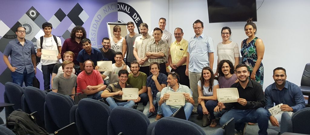
The #SanJuanINSPIREHackathon is over. All the teams did excellent work! The jury was impressed and it was really hard to evaluate the projects and select the winner.

Finally, the results are:

  • 1st place – Agrohacks
  • 2nd place – Cammalot
  • 3rd place (with the equal score) – Equipo INAUT & P.G.I.C.H
  • 4th place – Remote Sensing UNSJ Argentina

Final presentations of the team’s projects follow.

Agrohacks

Down To Earth ~ a tool alerting farmers about forecasted severe weather conditions

Cammalot

Forecast enhancement with weather station data

Prezi prezentation

Equipo INAUT

Application for reduction of agrochemicals in crops

PGICH

Water and temperatures analysis for wine production

RS UNSJ

Remote sensing data for agriculture

Provided data, tools and other infrastructure

The registered teams will be provided with three preprocessed data sets from the surroundings of San Juan:

  • Climatic data downloaded from Copernicus Climate Data Store, namely ERA 5-Land data.
  • Digital Elevation Model downloaded from SRTM, resp. the source OF DEM is ALOS Global Digital Surface Model called AW3D30 – For more information see https://www.eorc.jaxa.jp/ALOS/en/aw3d30/index.htm (registration needed for downloading data).
  • Sensor data of soil water potential, soil temperature, air temperature air humidity, from period 2016/01/26 – 2017/03/13. See a gpx file for the localization of the sensors and details about the measured quantities.

Moreover, the teams will get access to EUXDAT online platform allowing python coding together with access to the provided data (detailed information will follow.

Additionally to the data and the platform, the teams will be provided by inspiration of what can be achieved by the use of climatic data combined with sensor and elevation data by showing:

There will be a room with internet access available. However, teams are supposed to bring their own hardware.

Challenge

The teams will be then challenged to follow the basic experiment described or/and to invent their own way of potential usage of the provided data and tools.

All of the following types of outcomes are acceptable as hackathon results:

  • concept of what can be achieved with the data
  • basic algorithm description
  • working prototype

All presented hackathon results will be then evaluated by the expert jury and the first three teams will be awarded:

  • 1st prize – USD 200
  • 2nd prize – USD 100
  • 3rd prize – USD 50

Jury

Registration

In order to participate in the hackathon, please register your team here. Please note that the expected team size is 2-6 persons. Each team should have a name (to distinguish among teams) and a contact person who will communicate with the organizers.

Venue

The hackathon takes place in the Sala Azul on the second floor of Rector’s Building of the National University of San Juan, Bartolomé Mitre 396 – Este – capital San Juan.

Preliminary timeline

The hackathon run from Tuesday 19.11.2019 to Friday 22.11.2019. Please note that the following details still can be a subject of change:

  • Tuesday morning:
    • 8:30 – 8:55 ~ registration of teams
    • 9:00 – 9:30 ~ hackathon opening
    • 9:30 – 10:00 ~ detailed information of the hackathon organization, including initial information about the hackathon topic, including a description of data to be used + platform, which can be used
    • 10:00 – 11:00 ~ team’s introduction (3-5 min for each team, no presentation needed – please focus on the description of your initial idea). 
  • Tuesday afternoon – Friday morning
    • hacking, ad hoc consultations.
  • Friday afternoon
    • 14:00 – 15:30 ~ Presentation of results (each team has 10 minutes for presentation + 5 minutes for Q&A  
    • 15:30 – 16:00 ~ Evaluation of the teams by jury
    • 16:00 – 16:30 ~ Awarding and closing ceremony


ORGANISERS AND SUPPORTERS

DataBio (http://databio.eu/) – The data intensive target sector selected for the DataBio project is the Data-Driven Bioeconomy, focusing in production of best possible raw materials from agriculture, forestry and fishery/aquaculture for the bioeconomy industry to produce food, energy and biomaterials taking into account also various responsibility and sustainability issues. DataBio proposes to deploy a state of the art, big data platform “on top of the existing partners” infrastructure and solutions – the Big DATABIO Platform. The work will be continuous cooperation of experts from end user and technology provider companies, from bioeconomy and technology research institutes, and of other partners. In the pilots also associated partners and other stakeholders will be actively involved. The selected pilots and concepts will be transformed to pilot implementations utilizing co-innovative methods and tools where the bioeconomy sector end user experts and other stakeholders will give input to the user and sector domain understanding for the requirements specifications for ICT, Big Data and Earth Observation experts and for other solution providers in the consortium.

EUXDAT – (http://www.euxdat.eu)  proposes an e-Infrastructure, which addresses agriculture, land monitoring and energy efficiency for a sustainable development, as a way to support planning policies. In order to do so, we need to address the problems related to the current and future huge amount of heterogeneous data to be managed and processed. EUXDAT builds on existing mature components for solving them, by providing an advanced frontend, where users will develop applications on top of an infrastructure based on HPC and Cloud. The frontend provides monitoring information, visualization, different parallelized data analytic tools and enhanced data and processes catalogues, enabling Large Data Analytics-as-a-Service. EUXDAT will include a large set of data connectors (UAVs, Copernicus, field sensors, etc.), for scalable analytics. As for the brokering infrastructure, EUXDAT aims at optimizing data and resources usage. In addition to a mechanism for supporting data management linked to data quality evaluation, EUXDAT proposes a way to orchestrate tasks execution, identifying whether the best target is a HPC center or a Cloud provider. It will use monitoring and profiling information for taking decisions based on trade-offs related to cost, data constraints, efficiency and resources availability. During the project, EUXDAT will be in contact with scientific communities, in order to identify new trends and datasets, for guiding the evolution of the e-Infrastructure. The final result of the project will be and integrated e-Infrastructure which will encourage end users to create new applications for sustainable development.

NextGEOSS (http://nextgeoss.eu/) –  

The NextGEOSS project, a European contribution to GEOSS (Global Earth Observation System of Systems), is developing the next generation centralised European data hub and cloud platform for Earth Observation data, where the users can connect to access data and deploy Earth observation based applications. The concept revolves around providing the data and resources to the user communities, together with cloud resources, seamlessly connected to provide an integrated ecosystem for supporting applications.  A central component of NextGEOSS is the strong emphasis put on engaging the communities of providers and users, and bridging the space in between.

EO4Agri – (http://eo4agri.eu/)

The main objective of EO4AGRI is to catalyze the evolution of the European capacity for improving operational agriculture monitoring from local to global levels based on  information derived from Copernicus satellite observation data and through exploitation of associated geospatial and socio-economic information services. EO4AGRI assists the implementation of the EU Common Agricultural Policy (CAP) with special attention to the CAP2020 reform, to requirements of Paying Agencies, and for the Integrated Administration and Control System (IACS) processes. EO4AGRI works with farmers, farmer associations and agro-food industry on specifications of data-driven farming services with focus on increasing the utilization of EC investments into Copernicus Data and Information Services (DIAS). EO4AGRI addresses global food security challenges coordinated within the G20 Global Agricultural Monitoring initiative (GEOGLAM) capitalizing on Copernicus Open Data as input to the Famine Early Warning System Network (FEW-NET). EO4AGRI assesses information about land-use and agricultural service needs and offers to financial investors and insurances and the potential added value of fueling those services with Copernicus information. The EO4AGRI team consists of 11 organizations, complementary in their roles and expertise, covering a good part of the value-chain with a significant relevant networking capital as documented in numerous project affiliations and the formal support declarations collected for EO4AGRI. All partners show large records of activities either in Copernicus RTD, governmental functions, or downstream service operations. The Coordinator of EO4AGRI is a major industrial player with proven capacities to lead H2020 projects. The EO4AGRI project methodology is a combination of community building; service gap analysis; technology watch; strategic research agenda design and policy recommendations; dissemination (incl. organization of hackathons).

AFarCloud – AFarCloud will provide a distributed platform for autonomous farming, which will allow the integration and cooperation of Cyber Physical Systems in real-time for increased agriculture efficiency, productivity, animal health, food quality and reduced farm labour costs. This platform will be integrated with farm management software and will support monitoring and decision-making, based on big data and real time data mining techniques.

The DataBio Project Starts Trials of 26 Bioeconomy Pilots

7th August 2018, DataBio Press Release:

The development of a sustainable bioeconomy in Europe is expected to get a big boost from Big Data technologies thanks to a project co-funded by the EU’s Horizon 2020 programme.

The European Union’s Data-Driven Bioeconomy (DataBio) project has announced the launch of 26 different pilot trials, which are already underway in 17 countries. They will provide “real world” insights relevant for policymakers and producers – the farmers, foresters and fishermen engaged in Europe’s bioeconomy.

DataBio is using Big Data technologies to support the growth of Europe’s bioeconomy. More specifically, the project is handling massive flows of data collected through sensors placed in the soil and air, as well as from aerial and satellite imagery.

The DataBio consortium includes 48 partners from 17 countries and over 100 associated organisations.

The project’s mission is driven by the development, use and evaluation of the 26 new pilots covering agriculture (13), forestry (7) and fishery (6). The aim is to contribute to the production of the best possible raw materials from the three sectors to improve the output of food, energy and biomaterials.

The project is deploying over 90 state-of-the-art Big Data, Earth Observation and ICT technologies, linked together through the DataBio Platform. DataBio modelled the pilots and the technologies from a number of perspectives (e.g. technical and data, business motivation and processes, strategic) and developed the first version of the DataBio platform. The technologies have been matched and combined with each other to form innovative complex solutions for each pilot.

Now that the pilots have started their first trials, the project is one step closer to achieving its goal to demonstrate how these solutions can offer real added value to bioeconomy businesses.

The DataBio project coordinator, from INTRASOFT International, Dr Athanasios Poulakidas, said: “We are very excited, anticipating tangible success stories showing there is real value for all in using Big Data technologies in bioeconomy.”

Agriculture pilots

Precision agriculture in olives, fruits, grapes (Greece): A smart farming pilot to promote sustainable practices by providing policy advice on irrigation, fertilisation and pest/disease management. The exploitation of heterogeneous data, facts and scientific knowledge is aimed to facilitate decision-making and ensure smooth implementation of policy advice in the field. Deployed at three different sites in Greece, the pilots target olives, peaches and grapes.

Precision agriculture in vegetable seed crops (Italy): Harvesting plants at the right stage of maturity is vital to ensure the seed produced is of high quality. Currently, it is up to farmers, with the help of seed experts, to decide about harvesting and this is usually based on experience and observation. The scope of the pilot is to support farmers with the use of satellite telemetry.

Precision agriculture in vegetables seed crops (Netherlands): Potato growers aim to furnish them with higher and more predictable yields in a sustainable manner. Farmers will use a crop monitoring and benchmarking system using satellite data that provides information on the crop status based on weather data and greenness index data.

Big Data management in greenhouse eco-systems (Italy): This pilot implements genomic selection models, with particular focus on tomatoes, to support the greenhouse horticulture value chain.

Cereals, biomass and fibre crops (Spain): Using Earth Observation imageries and Internet of Things (IoT) sensor data, the pilot will map different areas in Spain and set up an informative management system for irrigation and early warning of heterogeneities or malfunctions of irrigation systems. The users of this service will be farmers, irrigation communities and public administrations.

Cereals, biomass and fibre crops (Greece): A smart farming pilot to promote sustainable practices by providing policy advice on irrigation. The exploitation of heterogeneous data, facts and scientific knowledge is aimed to facilitate decision-making and ensure smooth implementation of policy advice in the field. The target crop type is cotton.

Cereals, biomass and fibre crops (Italy): The pilot uses remote and proximal sensors for biomass crop prediction and management. The biomass crops include sorghum, fiber hemp and cardoon that can be used for several purposes including biofuel, fiber, and biochemicals respectively.

Cereals, biomass and fibre crops (Czech Republic):  To develop the web-based webGIS platform for mapping crop vigour, this pilot integrates Earth Observation data as a support tool for variable rate application of fertilisers and crop protection. This includes identification of crop status, mapping of spatial variability and delineation of management zones.

Machinery management (Czech Republic): This pilot is focused mainly on collecting telematic data from tractors and other farm machinery to analyse and compare to other farm data. The main goal is to collect and integrate data and receive comparable results. A challenge associated with this pilot is that a farm may have tractors and other machinery from manufacturers that use different telematic solutions and data ownership/sharing policies.

Insurance (Greece): To promote a damage assessment methodology and services dedicated to the agricultural insurance market, this pilot will eliminate the need for on-the-spot checks and to speed up the claims pay-out process. It uses data from Earth Observation platforms and Internet of Things agro-climate sensors to assess the impact of climate-related systemic perils (e.g. high/low temperatures, flood, drought) on high-value crops.

Farm Weather Insurance Assessment (Italy): The aim of this pilot is to provide and assess a test area of services for the agriculture insurance market, in particular risk assessment related to weather conditions and damage assessment. It is based on the analysis of satellite data, which is correlated with meteorological data and other ground-available data.

Common Agricultural Policy (CAP) Support (Italy and Romania): The objective of this pilot is to support the CAP by utilising Earth Observation data to identify the crop types in farm areas. Products and services will be fine-tuned to achieve requirements set out in the 2015-2020 EU CAP policy. The pilot will provide information layers and indicators to support European Paying Agencies with different levels of aggregation and details up to farm level.

Common Agricultural Policy (CAP) Support (Greece): This pilot evaluates a set of Earth Observation-based crop classification services, which deal effectively with the newly introduced CAP demands for systematic multi-crop agricultural monitoring, tracking and assessment of eligibility conditions. The proposed services use “traffic lights” colour-coding to protect the farmers against errors during the submission of greening applications.

Forestry pilots

Easy data sharing and networking (Finland): The Wuudis platform is used to interface with Finland’s forest authority. New networking features have been added, such as a work quality monitoring app. This will streamline and ensure transparency of subsidy payments, saving enormous amounts of time.

Monitoring and control tools for forest owners (Finland): This pilot adds crowdsourcing services to the Wuudis platform, interfacing with Finland’s forest service portal. This aims to better monitor forest damage (such as storms, snow, pests, diseases).

Forest damage remote sensing (Finland): This pilot aims to create a forest inventory monitoring service by using data collected by Unmanned Aerial Vehicles (UAVs) on Wuudis.

Monitoring of forest health (Spain): Using satellite data, Unmanned Aerial Vehicles (UAV) imagery and field data, this pilot is developing a methodology for the early detection and monitoring of plagues and diseases affecting forests. The study cases are Gonipterus affecting Eucalyptus and Phytophtora affecting Quercys Illex. The final product will be used by public administrations for optimal decision-making.

Invasive alien species control and monitoring (Spain): Using Big Data sources such as trading and travelling datasets, in addition to weather and climate information, this pilot is developing a methodology for the creation of Alien Invasive Species risk maps. The indexes obtained are related to the susceptibility of ecosystems to be invaded. The final product will be used by public administrations.

Web-mapping service for government decision-making (Czech Republic): Big satellite data are processed in novel ways to yield forest health trends. To do so, all available satellite observations are used, validated against extensive in-situ database of forest health. Resulting forest health maps are published as a web-mapping service and used by the Ministry of Agriculture for subsidy payments.

Shared multiuser forest data environment (Finland): Finland’s forestry service portal will be extended to offer more forest data services, including using crowdsourced ones and connectivity with the national service architecture. It will encourage the utilisation of standardised and open forest data for developing new services that will benefit the entire forestry sector.

Fishery pilots

Oceanic tuna fisheries immediate operational choices: The goal of this pilot is to improve vessel energy efficiency in oceanic tuna fisheries and engine preventive maintenance by providing support tools for operational choices, such as vessel loading, weather routing and condition-based maintenance, for Basque fishery vessels. Big Data approaches will build models using engine, propulsion, meteorological and historical data and the vessels design.

Small pelagic fisheries immediate operational choices: This pilot focuses on energy optimisation in Norwegian pelagic fisheries through operational support tools for deciding propulsion mode (diesel-electric, diesel-mechanic and various hybrid configurations) and power generation (use of shaft generator and auxiliary engines). The expected outcome is an on-board application that displays in real-time, current fuel consumption and the best alternatives for propulsion modes and energy production.

Oceanic tuna fisheries planning: The aim of this pilot is to use data from Earth Observation satellites and from buoys used by fishermen, to produce real-time fisheries route planning. This will also allow for eco-friendlier fisheries by means of consuming less fuel for fishing in a sustainable manner.

Small pelagic fisheries planning: This pilot aims to demonstrate how the use of Big Data technologies can provide crew and shipowners with information in a manner that benefits fisheries planning, for example for finding the best suitable fishing grounds. This pilot targets Norway’s small pelagic fisheries.

Pelagic fish stock assessments: The pilot aims to show that a combination of information from various data assets may help produce better fish population estimates for pelagic fish stocks in the Norwegian fishing zones. It is anticipated that a crowdsourced data collection effort combined with public/private data assets and data analytics can increase both the accuracy and precision of stock assessments.

Small pelagic market predictions and traceability: This pilot will leverage Big Data technologies for pelagic price prediction based on various market data relevant for pelagic fisheries, such as catch and landing data and International fisheries export and market data. Near-future pelagic price predictions will be used for catch value optimisation.


For further information, check https://www.databio.eu/en/

Contact us: info@databio.eu

Visualisation of Copernicus Marine Environment Monitoring Services

During the DataBio code camp in Darmstadt (27-29 March 2018) the web map application that displays data from selected WMS Time (WMS-T) services (main physical and bio indicators of the water such as water temperature, water salinity, chlorophyll concentration etc.) from Copernicus Marine Environment Monitoring Services (CMEMS) web-page (http://marine.copernicus.eu) as well as some custom WMS-T services that are needed for DataBio project was created. The application is currently running at  http://ng.hslayers.org/examples/databiocc . It is based on the HSLayers.js library (http://ng.hslayers.org/) . This example is a 3d extension of HSLayers which is based on the CESIUM platform.

The application provides an easy visual way to browse the data available at CMEMS web page. For someone it could be a tool to explore and discover something interesting from the maps about the world, and for someone, like, scientists a visual way to explore the data before they decide on whether they would like to go to CMEMS web page and download raw data and use it in their analysis.

Future plans include visualisation of more WMS-T services. Currently displayed WMS-T services from CMEMS have two dimensions in fact time and depth. For now, the user can select only time dimension and the depth is by default set to nearly surface water level. The application could be extended by a slider for the depth level.

Figure 1 Ocean temperature

Figure 2 Chlorophyll concentration in the ocean

[Author Dmitrii Kozhukh]